
How It Works The Fundamentals You Should Understand
What makes maps.video different, cost-effective and how that helps paving, utilities and infrastructure contractors
The application was intuitive to use and displayed exactly the kind of information we needed to show to our clients. It was very convenient not having to download additional software on the user or client side. Whenever video roadway survey work comes along, we know who to turn to!
— Donovan Bradshaw, Lead Geotechnical Engineer

Loved it. Having worked with it the past few months with a few guys, it’s been very easy to work with. With the amount of video files we have, all we need to have is an external hard drive plugged in and that’s it. Earlier this week, we sat down with the town to show them the work we’ve done, and they loved it as well
. — Victor Zhang, PE Sr. Structural/Bridge Engineer
The maps.video local application has made it really easy to access and control HD video playback, which has made determining the location of roadway features very efficient. It’s allowed me to create a fully mapped video library of a city or town’s road network using hardware (GoPro cameras) that I already owned.
— Lance Baden, Consultant

The application was intuitive to use and displayed exactly the kind of information we needed to show to our clients. It was very convenient not having to download additional software on the user or client side. Whenever video roadway survey work comes along, we know who to turn to!
— Donovan Bradshaw, Lead Geotechnical Engineer
Loved it. Having worked with it the past few months with a few guys, it’s been very easy to work with. With the amount of video files we have, all we need to have is an external hard drive plugged in and that’s it. Earlier this week, we sat down with the town to show them the work we’ve done, and they loved it as well
. — Victor Zhang, PE Sr. Structural/Bridge Engineer
The maps.video local application has made it really easy to access and control HD video playback, which has made determining the location of roadway features very efficient. It’s allowed me to create a fully mapped video library of a city or town’s road network using hardware (GoPro cameras) that I already owned.
— Lance Baden, Consultant
The Fundamentals
The things you should understand
100% Local Video Privacy
No videos are uploaded to maps.video and maps.video does not stream videos from its servers. Your videos remain within and never leave your organisation.
Instant Local GPS Extraction
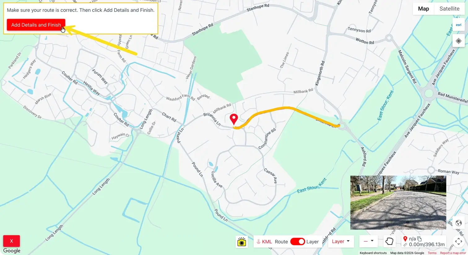
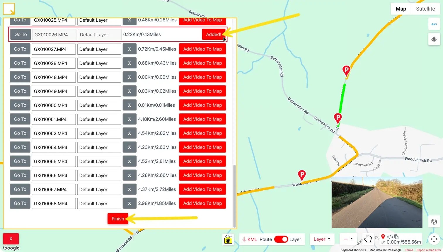
The orange progress bar you see when adding videos is the GPS data being extracted. Uploading ultra-definition video is slow, and transcoding, storing, and streaming those videos in the cloud is extremely expensive.
Prohibitive Cloud Streaming Costs
Streaming videos are great for Netflix films, but for infrastructure videos it is prohibitively expensive, with utility companies and contractors often having hundreds or thousands of high-definition videos.
Local Browser Playback
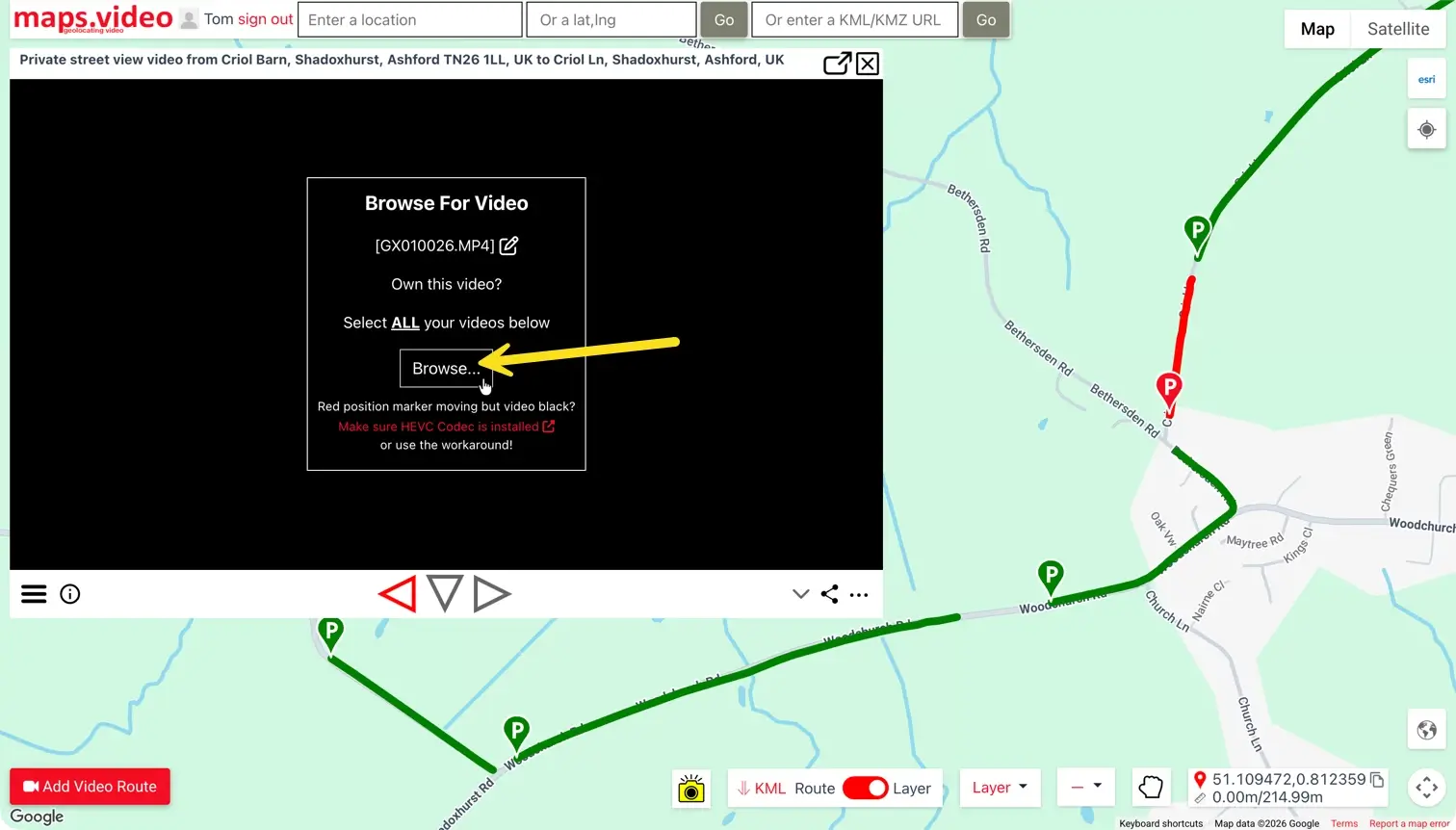
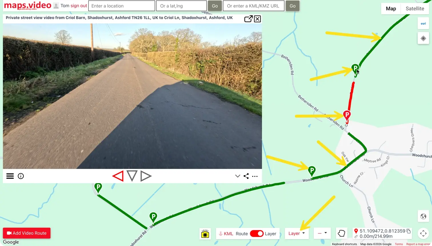
Instead, using maps.video, the GPS data is extracted locally, submitted to the cloud, and videos are locally loaded and viewed directly within your browser.
Original Quality & No Buffering
No extra compression is added to the videos, allowing the end user to view the original quality instantly with zero buffering.
Cost-Effective Cloud Storage
Locally loading videos is very cost-effective. If required, you can store and download videos from cloud storage providers e.g. Microsoft SharePoint for a small monthly fee.
How to Use maps.video
Everything you need to make full use of maps.video
1. Transfer from GoPro
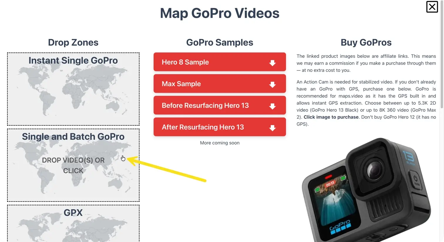
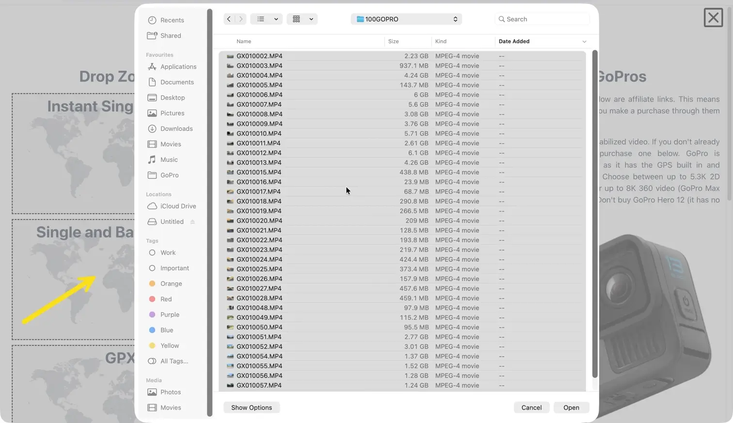
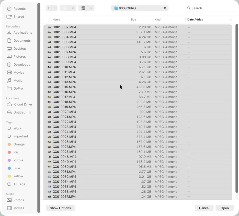
Record your videos with a GoPro Hero or Max, remove the SD card, and transfer the videos to your computer.
2. Install HEVC Codec
If you are on a PC, make sure you install the HEVC codec.
3. Open the Map
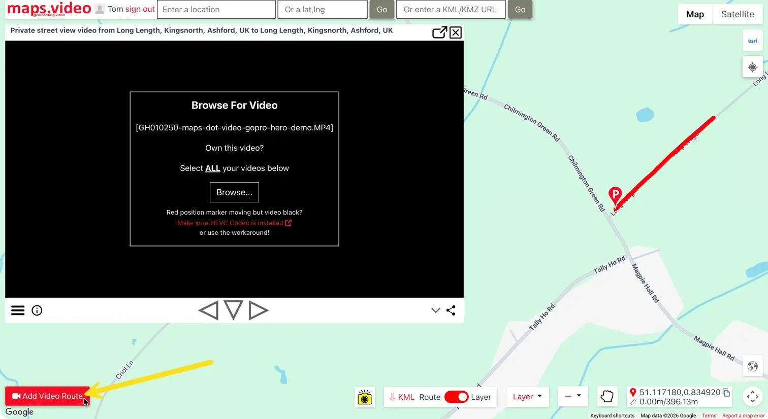
Go to the map (sign up if you have not already).
4. GoPro Max .360 Files
If you have GoPro Max .360 videos, they will need to be processed by following these instructions.
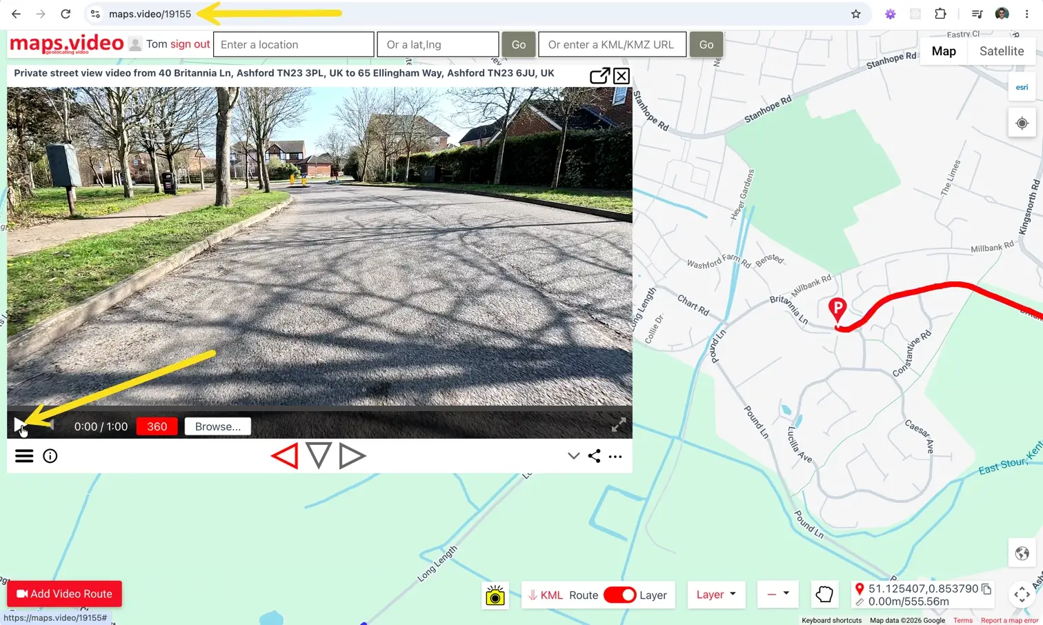
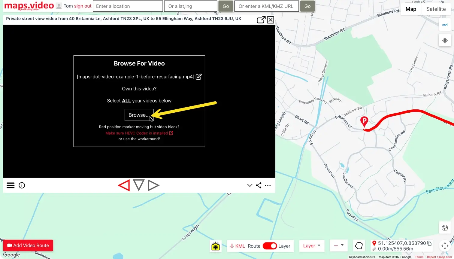
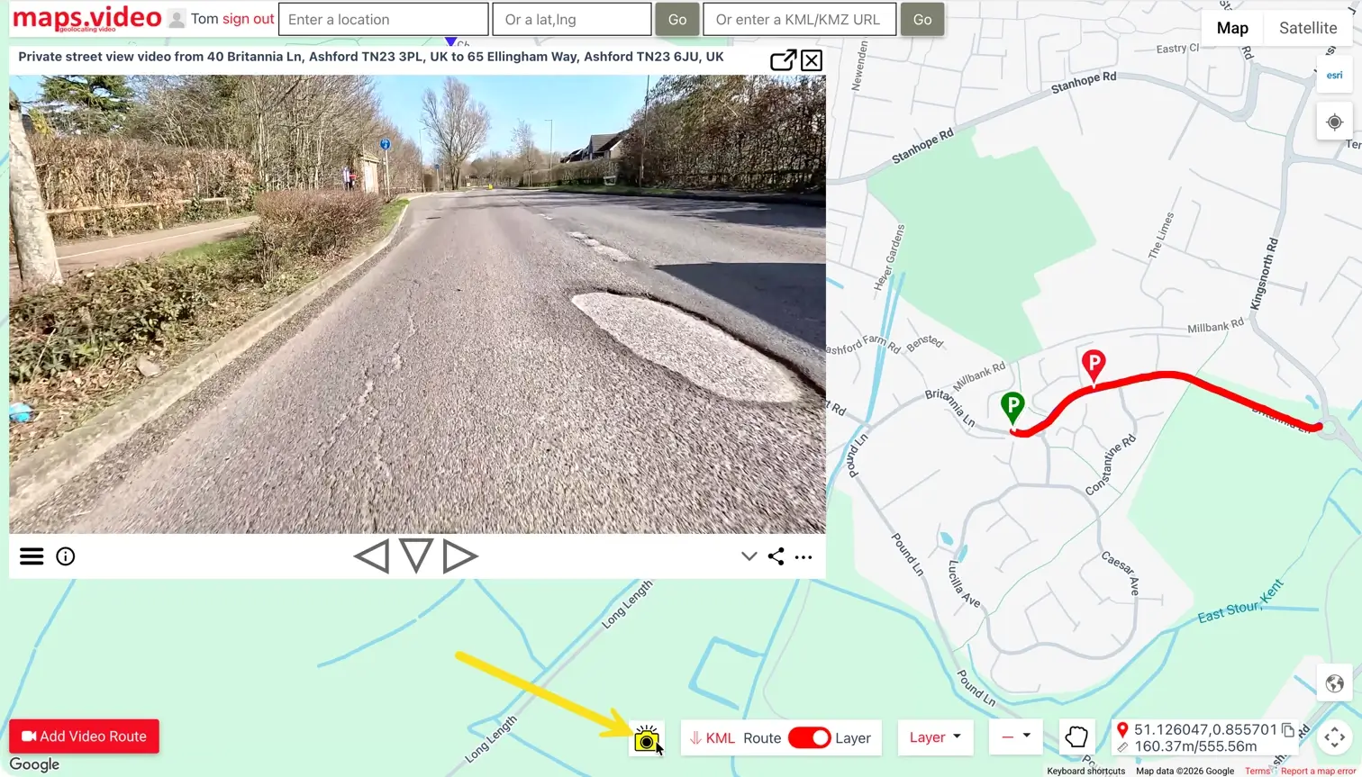
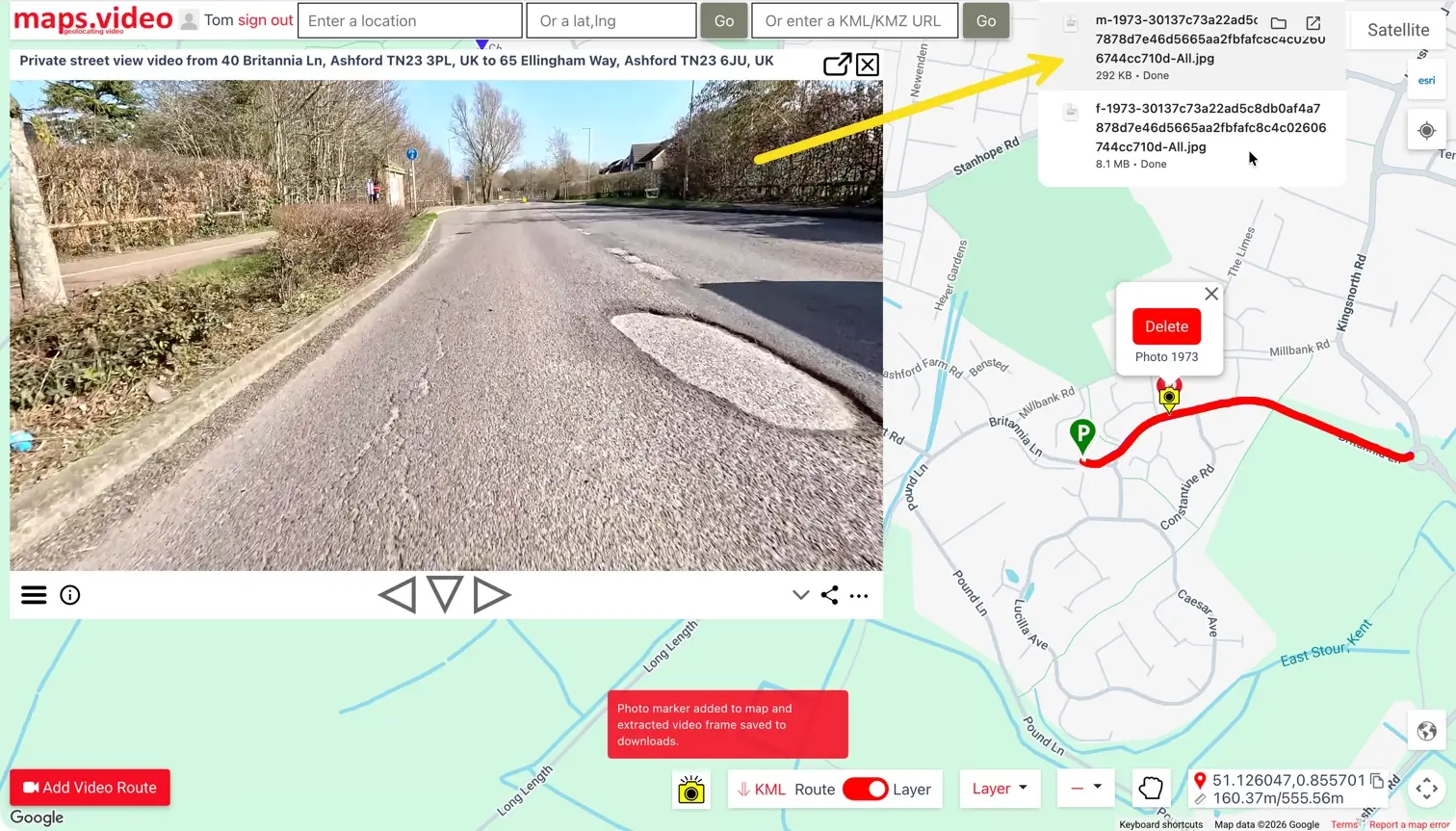
Step-by-Step Walkthrough
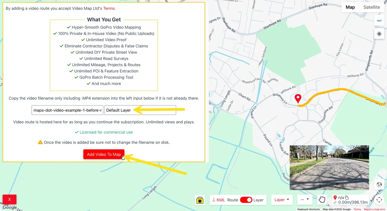
Follow the visual workflow below to map your survey footage
How maps.video Helps Civil & Infrastructure Teams
Tailored visual proof and operational workflows for paving, utilities, and civil engineering
Paving & Surfacing Contractors
Capture pre-installation dilapidation surveys across miles of road networks. Prove pre-existing asphalt cracks or curb defects, document binder course layers, and rapidly verify completed resurfacing work for payment approvals.
Utility Trenching & Pipeline Teams
Create unassailable visual logs of gas, water, or fiber corridor excavations. Document exact backfill quality, ducting runs, and pavement reinstatement before crews backfill trenches or hand off to municipal inspectors.
Pre-Existing Damage Defense
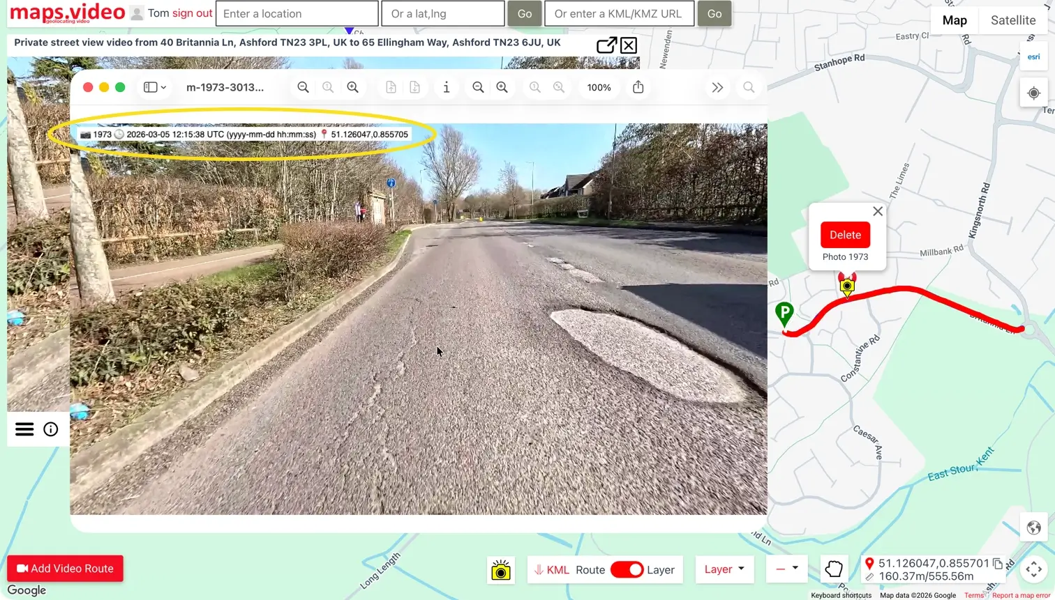
Protect against unearned third-party property claims, utility strike accusations, or council penalties. Extract geotagged and time-stamped video frames showing exact site conditions prior to crew mobilization.
Frictionless GIS & Client Sign-Offs
Extract timestamped and geolocated JPEGs directly into ArcGIS or QGIS desktop environments, or share location-stamped video frame exports to give clients zero-friction proof of work without cloud software locks.
"The maps.video local application has made it really easy to access and control HD video playback... It's allowed me to create a fully mapped video library of a city or town's road network using hardware (GoPro cameras) that I already owned."
Upgrade Your Infrastructure Field Documentation Today
Stop relying on fragmented photos and unverified reports to document critical infrastructure. Elevate your documentation standards, speed up client approvals, and build an unassailable record of your work.
Test maps.video with Sample Footage