
Road Dilapidation Surveys GPS Video Mapping & Stamped Frame Proof
Protect your council security bonds, document pre-existing road and kerb defects along heavy haulage routes, and deliver comprehensive Australian dilapidation reports—without uploading raw video.
The application was intuitive to use and displayed exactly the kind of information we needed to show to our clients. It was very convenient not having to download additional software on the user or client side. Whenever video roadway survey work comes along, we know who to turn to!
— Donovan Bradshaw, Lead Geotechnical Engineer

Loved it. Having worked with it the past few months with a few guys, it’s been very easy to work with. With the amount of video files we have, all we need to have is an external hard drive plugged in and that’s it. Earlier this week, we sat down with the town to show them the work we’ve done, and they loved it as well
. — Victor Zhang, PE Sr. Structural/Bridge Engineer
The maps.video local application has made it really easy to access and control HD video playback, which has made determining the location of roadway features very efficient. It’s allowed me to create a fully mapped video library of a city or town’s road network using hardware (GoPro cameras) that I already owned.
— Lance Baden, Consultant

The application was intuitive to use and displayed exactly the kind of information we needed to show to our clients. It was very convenient not having to download additional software on the user or client side. Whenever video roadway survey work comes along, we know who to turn to!
— Donovan Bradshaw, Lead Geotechnical Engineer
Loved it. Having worked with it the past few months with a few guys, it’s been very easy to work with. With the amount of video files we have, all we need to have is an external hard drive plugged in and that’s it. Earlier this week, we sat down with the town to show them the work we’ve done, and they loved it as well
. — Victor Zhang, PE Sr. Structural/Bridge Engineer
The maps.video local application has made it really easy to access and control HD video playback, which has made determining the location of roadway features very efficient. It’s allowed me to create a fully mapped video library of a city or town’s road network using hardware (GoPro cameras) that I already owned.
— Lance Baden, Consultant
In Australian civil construction, land development, and resource extraction, conducting a pre-construction road dilapidation survey is a mandatory requirement before mobilizing heavy plant or breaking ground. Local Government Authorities (LGAs) and state road authorities across Australia routinely enforce strict Asset Protection Permits and Works in Road Reserve approvals. Civil contractors, structural engineers, and site developers must establish an undeniable baseline of council road corridors, kerb and gutter assets, footpaths, crossovers, and nature strips prior to construction activities.
When heavy construction vehicles, haulage trucks, or directional drilling rigs operate near municipal assets, local councils frequently hold contractors liable for pre-existing pavement cracking, kerb displacement, or damaged drainage pits. If you cannot conclusively prove that road degradation occurred prior to mobilization, council asset protection security bonds can be withheld for months. Traditional dilapidation survey methods create significant operational and administrative headaches:
- Fragmented Photo Logs: Taking hundreds of handheld smartphone JPEGs across kilometers of council roads creates an unorganized digital mess. Loose photos lack continuous linear route alignment, exact chainage tracking, and clear spatial context across long road segments.
- Unmanageable Raw Video Files: Driving road corridors with standard video cameras yields massive MP4 files. Finding a specific five-second clip showing a pre-existing kerb crack or sagging asphalt joint requires hours of tedious manual video scrubbing.
- Cellular Data & Cloud Upload Bottlenecks: High-definition 4K field video produces dozens of gigabytes per survey. Uploading raw video over regional Australian mobile networks is slow, expensive, and impractical for field engineering teams.
- Council Portal & Security Link Barriers: Australian council asset engineers, shire inspectors, and third-party auditors generally reject third-party video portal logins or external hosted links due to strict municipal cybersecurity guidelines.
Maps.video solves these challenges with a local-first GPS video mapping system. Purpose-built for off-the-shelf GoPro action cameras with internal GPS receivers, maps.video processes spatial telemetry directly inside your local web browser. There are zero cloud uploads, no recurring video hosting fees, and no unsecure shareable web links. Field engineers interactively scrub mapped road routes locally and export geotagged, timestamped video frames—stamped photo proof containing precise GPS coordinates and dates—ready to attach directly to formal Australian council dilapidation reports or email to asset protection officers.

Key Road Dilapidation Workflows Supported Across Australia
Safeguarding council security bonds and mitigating third-party risk requires verifiable, location-anchored visual evidence before moving heavy machinery onto site.
Pre-Construction Asset Protection
- Council Haul Route Baselines: Document pre-existing pavement distress, rutting, and shoulder wear along designated heavy vehicle transit roads.
- Kerb, Gutter & Footpath Audits: Capture visual baselines of layback crossovers, concrete kerbs, stormwater pits, and pedestrian paths prior to site access.
- Utility Corridor Pre-Work: Record existing surface conditions prior to micro-trenching, directional boring, or deep sewer connections in the road reserve.
Post-Construction Council Handover
- Security Bond Release Audits: Submit clear, location-stamped frame evidence to LGAs to prove no new road damage occurred during construction.
- Defect Liability Period (DLP) Handovers: Verify civil reinstatement quality, asphalt patching, and kerb restoration for council asset sign-off.
- Third-Party Claim Defense: Instantly refute false property owner or council claims by exporting pre-construction timestamped video frames.
- Protect Council Security Bonds: Ensure rapid release of asset protection bonds by providing local shires and councils with indisputable, timestamped visual proof.
- 100% Local Data Privacy: Keep sensitive project infrastructure footage safely on your local drive while exporting clean, professional, white-labeled frame proofs.
How maps.video Works for Road Dilapidation Surveys
Continuous video mapping and local proof-of-work extraction from GoPro cameras directly inside your web browser
Works with GoPro HERO13, HERO11, HERO10, HERO9, HERO8, HERO7, HERO6, HERO5, MAX2, MAX, Fusion, Session 5 and .gpx.
Record Road Corridors with GoPro Hardware
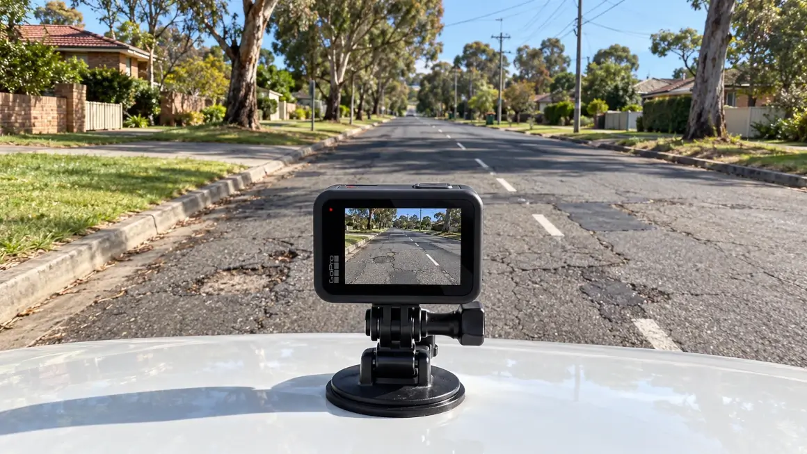
Mount a GPS-enabled GoPro camera to a survey ute, windshield, or inspection pole. Drive or walk the designated haulage routes and council road corridors while the camera automatically logs continuous spatial telemetry alongside HD video.
Extract Telemetry Locally in Your Browser
Open maps.video on your laptop and drag the GoPro MP4 file directly into the browser window. Telemetry is parsed locally on your device in seconds—no video files are uploaded over cellular or cloud networks.
Extract & Share Stamped Frame Proofs
Click any point along the rendered route map to jump directly to that exact frame in the recording. Export high-resolution, time- and location-stamped video frames to email directly to council engineers or attach to PDF dilapidation reports.
Core Technical Capabilities for Dilapidation Surveyors
Instant Local Telemetry Extraction
GoPro action cameras embed high-frequency GPS metadata directly within MP4 video streams. Maps.video parses this telemetry locally within your web browser without sending footage to external servers.
- Preserve mobile cellular data on remote regional Australian job sites.
- Eliminate cloud subscription fees and storage limits.
- Maintain complete data privacy by storing raw video locally.
Click-to-Coordinate Map Navigation
The local browser interface links an interactive vector map directly alongside your HD video player. Clicking any stationing point or asset location on the route map instantly syncs the video to that exact physical coordinate.
- Inspect kerb joins, drainage gullies, and pavement cracks at exact addresses.
- Verify pre-existing defects along miles of road in minutes without manual scrub delays.
- Extract geotagged video frames containing burned-in geographic coordinates.
KML/KMZ & Esri Engineering Layer Overlays
Import LGA boundary files, council road centerline alignments, or project CAD layers directly into the map view to compare recorded survey paths against official civil plans.
- Confirm survey coverage extends across all required council road reserves.
- Toggle Esri high-resolution satellite imagery via ArcGIS integration for spatial context.
- Identify road asset boundaries and boundary line offsets easily.
Frictionless White-Labeled Frame Exports
Council asset engineers, shire inspectors, and client project managers do not need software accounts, logins, or cloud access to review your dilapidation evidence.
- Export standalone image frames stamped with exact coordinates, dates, and times.
- Attach stamped proof images directly to standard PDF dilapidation reports.
- Maintain professional identity with clean, white-labeled output options.

Road Dilapidation Survey Documentation Workflow Comparison
How maps.video compares to traditional photo logs and unmapped video files
| Documentation Feature | Traditional Photo Logs | Standard Video Files | Maps.video Platform |
|---|---|---|---|
| Hardware Requirement | Smartphones / Cameras | Any Camcorder / Phone | GoPro GPS Action Cameras Only |
| Spatial Precision | Low (Isolated JPEG pins) | None (Single file tag) | Continuous GoPro GPS Path Linking |
| Data & Storage Model | Manual folder organization | Heavy cloud video uploads | 100% Local In-Browser Processing (Zero Uploads) |
| Sharing Method | Disorganized photo zip files | Unsecure shareable links | Export Stamped Frames (Email / Report Attachments) |
| Council Verification Speed | Slow (Searching loose photos) | Slow (Scrubbing unmapped MP4s) | Ultra-Fast (Click route point & export frame) |
| Design Layer Integration | Static PDF overlays | No map integration | Interactive KML/KMZ & Esri Basemaps |
Protecting Council Security Bonds & Speeding Permit Handovers
Withheld council asset protection bonds and disputed road reinstatement claims can stall project closeouts and lock up capital for months.
Traditional Council Dispute Cycle (30–90 Days)
Alleged Road Damage ➔ Unorganized Photo Searches ➔ Manual Site Re-Inspections ➔ Bond Retention ➔ Delayed Project Closeout
Maps.video Stamped Frame Workflow (1–2 Days)
Alleged Road Damage ➔ Open Local GoPro Survey ➔ Export Pre-Work Stamped Frame Proof ➔ Claim Dismissed & Fast Bond Release
By replacing fragmented smartphone photos with continuous local GoPro GPS mapping:
- Refute Unearned Council Damage Claims: Produce conclusive, timestamped, and geotagged visual proof showing exact road, kerb, and footpath conditions prior to site mobilization.
- Accelerate Security Bond Release: Provide LGA asset officers and shire engineers with clear frame proofs to close out Asset Protection Permits rapidly.
- Reduce Field Survey Overhead: Map kilometers of haul routes and road corridors in a single drive without stopping to take hundreds of manual phone photos.
Frequently Asked Questions
Everything you need to know about local GoPro GPS extraction and Australian road dilapidation survey deliverables
Q: Why does maps.video require GoPro cameras specifically?
A: GoPro action cameras feature robust built-in GPS receivers that capture precise spatial telemetry directly alongside high-definition video streams. Maps.video reads this embedded telemetry natively, eliminating the need for expensive external GPS units or custom mapping hardware.
Q: Does maps.video generate shareable video links for council inspectors?
A: No. Maps.video operates on a privacy-first, local-browser model with zero cloud uploads. Instead of shareable web links, you extract high-resolution, geotagged, and timestamped video frames directly from points along the mapped path to email or embed into reports.
Q: How do Australian local councils review dilapidation evidence?
A: Australian councils and asset officers prefer standard PDF dilapidation reports or direct email submittals. You export geotagged video frame proofs displaying exact coordinates, dates, and times, which attach seamlessly into standard civil dilapidation report templates.
Q: Can I overlay council LGA road networks or GIS boundaries onto the map?
A: Yes. Maps.video supports standard KML and KMZ spatial files. You can overlay council road centerlines, site boundary limits, utility alignments, and property easement lines directly over your interactive route map.
Built for Australian Civil Contractors, Structural Engineers, and Asset Officers
Integrating seamlessly into daily field operations using off-the-shelf GoPro hardware
For Civil Contractors & Superintendents
Ensure complete pre-construction baseline coverage along heavy haulage routes and surrounding council streets before moving heavy equipment onto site.
For Dilapidation Consultants & Structural Engineers
Build unassailable dilapidation reports for commercial developers and civil clients. Export clear, location-stamped video frame evidence in minutes.
For Council Asset Protection Officers
Review road reserve conditions, kerb reinstatements, and post-construction restorations with indisputable, location-stamped visual frame evidence.
"The maps.video local application has made it really easy to access and control HD video playback... It's allowed me to create a fully mapped video library of a city or town's road network using hardware (GoPro cameras) that I already owned."
Upgrade Your Australian Road Dilapidation Surveys Today
Stop relying on fragmented phone photos and unverified reports to document council road reserves. Elevate your dilapidation standards, protect your security bonds, and build an unassailable visual record of your work.
Test maps.video with Sample Footage