
KML and KMZ Map Layer Display Custom GIS Data on Your Map
Seamlessly render custom KML and KMZ map layers directly onto your interactive map. Paste any publicly hosted URL to visualize asphalt terminals, project boundaries, and asset markers instantly.
The application was intuitive to use and displayed exactly the kind of information we needed to show to our clients. It was very convenient not having to download additional software on the user or client side. Whenever video roadway survey work comes along, we know who to turn to!
— Donovan Bradshaw, Lead Geotechnical Engineer

Loved it. Having worked with it the past few months with a few guys, it’s been very easy to work with. With the amount of video files we have, all we need to have is an external hard drive plugged in and that’s it. Earlier this week, we sat down with the town to show them the work we’ve done, and they loved it as well
. — Victor Zhang, PE Sr. Structural/Bridge Engineer
The maps.video local application has made it really easy to access and control HD video playback, which has made determining the location of roadway features very efficient. It’s allowed me to create a fully mapped video library of a city or town’s road network using hardware (GoPro cameras) that I already owned.
— Lance Baden, Consultant

The application was intuitive to use and displayed exactly the kind of information we needed to show to our clients. It was very convenient not having to download additional software on the user or client side. Whenever video roadway survey work comes along, we know who to turn to!
— Donovan Bradshaw, Lead Geotechnical Engineer
Loved it. Having worked with it the past few months with a few guys, it’s been very easy to work with. With the amount of video files we have, all we need to have is an external hard drive plugged in and that’s it. Earlier this week, we sat down with the town to show them the work we’ve done, and they loved it as well
. — Victor Zhang, PE Sr. Structural/Bridge Engineer
The maps.video local application has made it really easy to access and control HD video playback, which has made determining the location of roadway features very efficient. It’s allowed me to create a fully mapped video library of a city or town’s road network using hardware (GoPro cameras) that I already owned.
— Lance Baden, Consultant
Screenshots and Instructions
How to load, render, and navigate custom spatial data files on your map
Display KML and KMZ layers on the map to help you do your work. Copy and paste a KML URL into the box at the top and submit. The file must be hosted at a publicly accessible URL on the internet.
As long as the KML file is not too large, the KML should appear on the map.
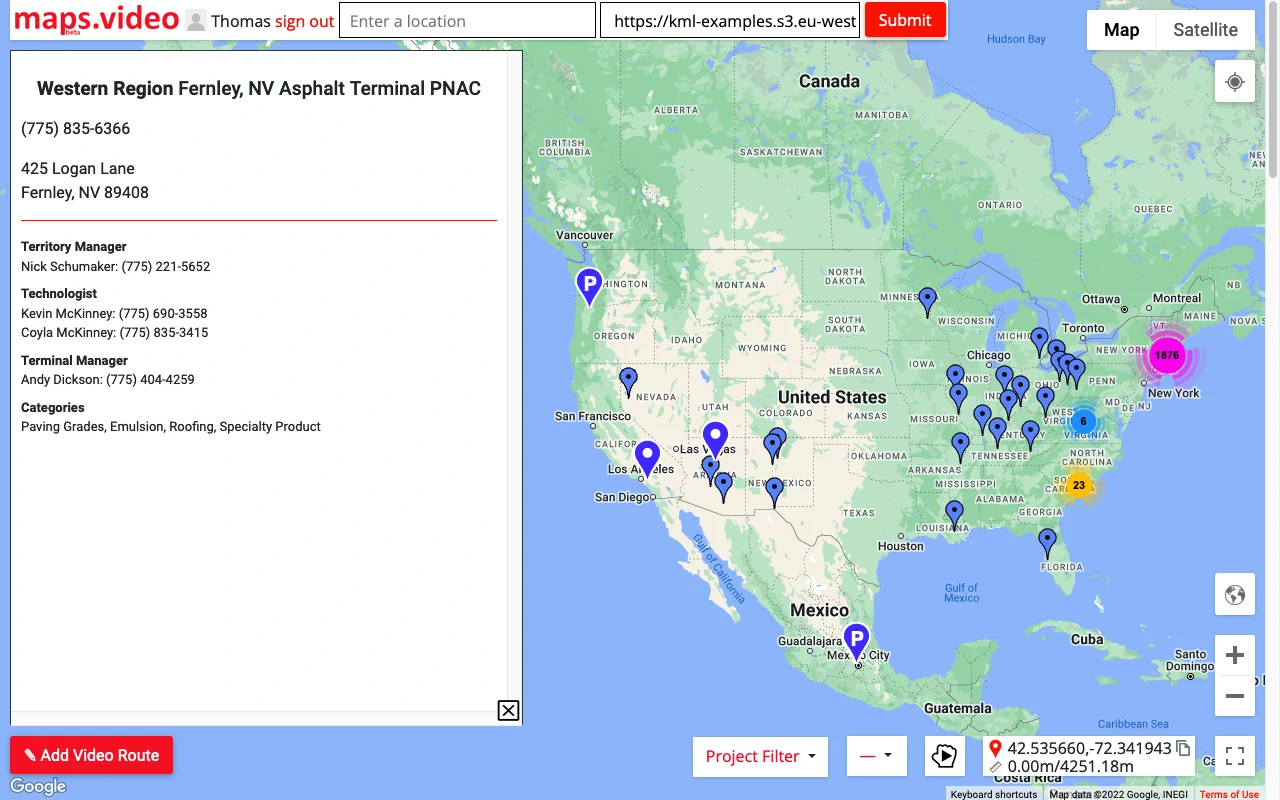
Here we have some Asphalt Terminal locations (the small blue pins). Click a pin to see information in the sidebar.
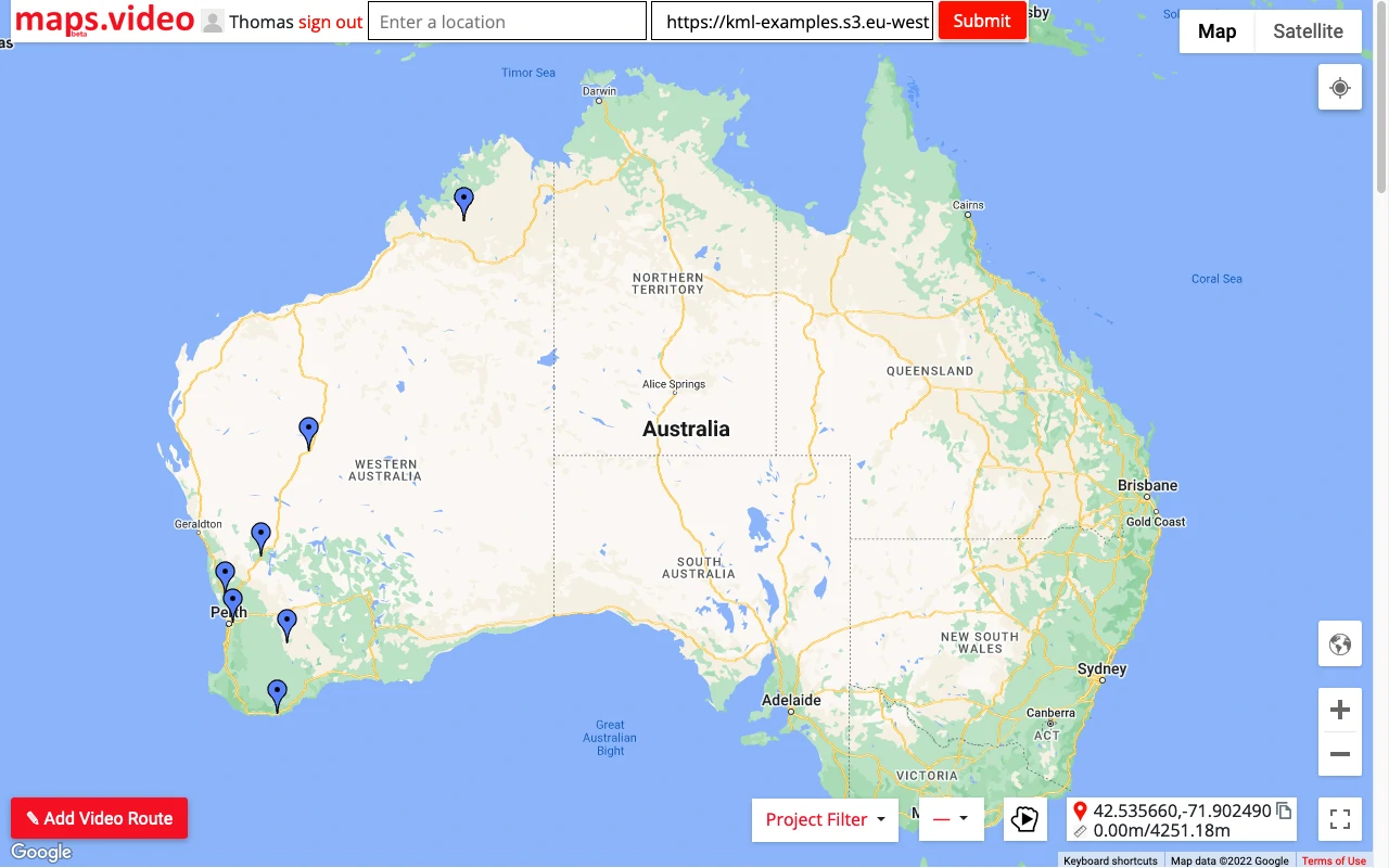
A map of Australia with some KML pins.
Here is a link to some information if your KML/KMZ does not load. If it is too large or in the wrong format it will not load on the map.
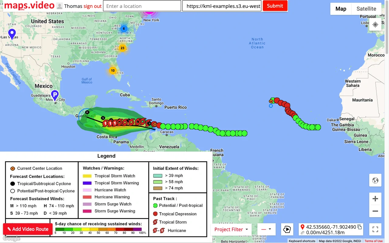
More complex KML/KMZ files can be rendered on the map. Here we have hurricane data in the Caribbean.
How KML/KMZ Layers Help Paving, Utilities, and Infrastructure
Overlay critical project data, asset markers, and corridor alignments directly onto your map workspace
For Paving & Highway Contractors
Overlay project boundaries, utility locations, and municipal right-of-way lines directly over video routes to ensure accurate milling and paving extents without guesswork.
- Visualize project stationing and reference lines in real-time.
- Display plant locations, staging yards, and material terminals.
- Match recorded video tracks against planned engineering alignments.
For Utility & Trenching Teams
Import existing utility network KML files to cross-reference underground asset locations, manholes, and valve boxes with real-time field video captures.
- Quickly identify existing utility crossings along long linear runs.
- Inspect surface iron adjustments relative to engineering specs.
- Streamline field coordination using custom asset marker overlays.
For Infrastructure & Public Works
Centralize regional data layers, inspection zones, and weather or environmental tracking data into a unified map workspace without complex desktop GIS software.
- Render complex multi-point KML files and regional boundaries instantly.
- Click map pins to pull up detailed metadata in the sidebar panel.
"The maps.video local application has made it really easy to access and control HD video playback... It's allowed me to create a fully mapped video library of a city or town's road network using hardware (GoPro cameras) that I already owned."
Enhance Your Map With Custom KML Layers Today
Bring your external GIS data and project boundaries directly into your video mapping workflow. Test out the platform with sample footage or load your own KML URLs instantly.