
Pre-Condition Road Surveys GPS Video Mapping & Defect Proof
Eliminate unjustified third-party damage claims, establish indisputable baseline road conditions, and map miles of pre-construction corridors—without uploading raw video.
The application was intuitive to use and displayed exactly the kind of information we needed to show to our clients. It was very convenient not having to download additional software on the user or client side. Whenever video roadway survey work comes along, we know who to turn to!
— Donovan Bradshaw, Lead Geotechnical Engineer

Loved it. Having worked with it the past few months with a few guys, it’s been very easy to work with. With the amount of video files we have, all we need to have is an external hard drive plugged in and that’s it. Earlier this week, we sat down with the town to show them the work we’ve done, and they loved it as well
. — Victor Zhang, PE Sr. Structural/Bridge Engineer
The maps.video local application has made it really easy to access and control HD video playback, which has made determining the location of roadway features very efficient. It’s allowed me to create a fully mapped video library of a city or town’s road network using hardware (GoPro cameras) that I already owned.
— Lance Baden, Consultant

The application was intuitive to use and displayed exactly the kind of information we needed to show to our clients. It was very convenient not having to download additional software on the user or client side. Whenever video roadway survey work comes along, we know who to turn to!
— Donovan Bradshaw, Lead Geotechnical Engineer
Loved it. Having worked with it the past few months with a few guys, it’s been very easy to work with. With the amount of video files we have, all we need to have is an external hard drive plugged in and that’s it. Earlier this week, we sat down with the town to show them the work we’ve done, and they loved it as well
. — Victor Zhang, PE Sr. Structural/Bridge Engineer
The maps.video local application has made it really easy to access and control HD video playback, which has made determining the location of roadway features very efficient. It’s allowed me to create a fully mapped video library of a city or town’s road network using hardware (GoPro cameras) that I already owned.
— Lance Baden, Consultant
Before launching major civil construction, utility trenching, directional drilling, or heavy haul operations, establishing a clear baseline of surrounding road infrastructure is vital. Municipal highway authorities, local councils, and private landowners frequently hold contractors accountable for pre-existing pavement distress, cracked kerbs, sunken ironwork, or damaged footways adjacent to active job sites.
When third parties file damage claims or withhold retainage, relying on unorganized mobile photos and paper inspection logs leaves contractors vulnerable. Traditional pre-condition survey workflows create immense operational friction:
- Dislocated Static Photos: Taking thousands of individual digital photos leaves continuous spatial gaps, lacks clear stationing context, and results in a disorganized file mess across miles of road.
- Unverifiable Baseline Evidence: Proving whether cracking, rutting, or kerb displacement existed prior to construction is nearly impossible without continuous, time-stamped visual coverage.
- Bandwidth & Cloud Storage Bottlenecks: Recording hours of high-definition corridor video creates massive file sizes. Uploading raw footage over field mobile networks is slow, expensive, and impractically CPU-heavy.
maps.video solves this core friction. By processing embedded GoPro GPS telemetry directly within your web browser, field survey teams instantly link video footage to interactive map routes locally. When proof of baseline conditions is required, you simply extract stamped, geotagged video frames corresponding to specific map coordinates to share directly with engineers, councils, or insurance assessors.

Key Pre-Condition Survey Audits Supported
Pre-construction risk management requires continuous visual verification across all adjacent surface assets prior to breaking ground.
Surface & Pavement Distress
- Baseline Pavement Defects: Document pre-existing alligator cracking, potholes, rutting, and joint spalling.
- Utility Ironwork & Drainage: Capture the exact pre-construction condition of manhole covers, gullies, and catch basins.
- Road Markings & Surface Dressings: Log faded striping, high-friction surfacing, and existing patch repairs.
Footway & Edge Infrastructure
- Kerb & Footway Condition: Record pre-existing cracked kerb stones, dropped kerbs, and damaged flagstones.
- Boundary & Wall Audit: Document condition of adjacent retaining walls, boundary fences, and private access points.
- Street Furniture & Signage: Log pre-construction state of bollards, lighting columns, and traffic signage.
- Shield Against False Damage Claims: Reject false claims from third parties by exporting timestamped video frames proving pre-existing road or footway defects.
- Accelerate Council Approvals: Submit clear, white-labeled visual pre-condition reports to local highway authorities before commencing excavation.
How maps.video Works for Pre-Condition Surveys
Continuous video mapping and local proof-of-work extraction from GoPro cameras directly inside your web browser
Works with GoPro HERO13, HERO11, HERO10, HERO9, HERO8, HERO7, HERO6, HERO5, MAX2, MAX, Fusion, Session 5 and .gpx.
Record Corridors with GoPro Hardware
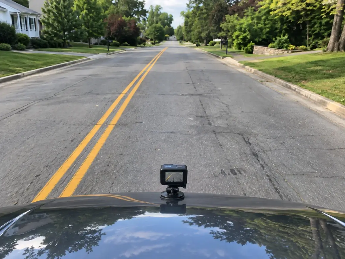
Mount a GPS-equipped GoPro to a survey vehicle, bicycle, or walking pole. Drive or walk the planned haul route, utility corridor, or site perimeter before work begins.
Extract Telemetry Locally in Browser
Open maps.video on your field laptop. Drag and drop the GoPro video file directly into the browser window. Telemetry is parsed instantly—no video files are uploaded over cellular connections.
Extract & Share Stamped Frame Proofs
Click key inspection points along the map line to extract stamped, geotagged video frames. Attach these baseline images directly into pre-construction logs and council submittals.
Core Technical Capabilities for Pre-Condition Surveys
Instant Local Telemetry Extraction
GoPro cameras log spatial metadata alongside video streams. Traditional platforms require heavy cloud uploads, but maps.video extracts GPS tracks instantly on your local device.
- Preserve mobile cellular data on remote highway survey runs.
- Eliminate cloud processing queues and rendering delays.
- Maintain total data privacy by keeping raw footage local.
Click-to-Coordinate Inspection
The local interface pairs an interactive vector map directly alongside your video player. Moving along the map route jumps the video player directly to that exact spot.
- Inspect exact stationing, kerb lines, and surface defects at specific points.
- Verify pre-existing crack patterns and pavement conditions across long routes.
- Extract geotagged video frames marked with precise GPS telemetry.
KML/KMZ & Esri Engineering Overlays
Upload project site boundaries, pipeline routes, or GIS spatial layers directly into the map view to compare site boundaries against recorded survey paths.
- Confirm survey coverage extends across all affected construction zones.
- Toggle Esri basemaps via ArcGIS integration for high-res satellite context.
- Cross-reference survey paths with highway authority boundary maps.
White-Labeled Deliverables
Highway engineers, councils, and property owners do not need software accounts or cloud logins to review your baseline evidence.
- Download GPS-stamped frames tied directly to map route locations.
- Exclusion of software vendor branding maintains total brand identity.
- Attach stamped photo evidence directly to pre-condition survey reports.

Pre-Condition Survey Documentation Workflow Comparison
How maps.video compares to traditional photo logs and unmapped video files
| Documentation Feature | Traditional Photo Logs | Standard Video Files | maps.video Platform |
|---|---|---|---|
| Spatial Precision | Low (Isolated JPEG pins) | None (Single file tag) | Continuous GoPro GPS Path Linking |
| Data Workflow | Manual image naming | High-bandwidth cloud uploads | Browser-Based Local Telemetry Extraction |
| Coverage Continuity | Spotty (Gaps between photos) | Continuous (Hard to navigate) | 100% Continuous & Map-Synchronized |
| Inspector Verification Time | High (Manual folder search) | High (Scrubbing long videos) | Ultra-Fast (Click route point & export frame) |
| Design Layer Integration | Static PDF overlays | No map integration | Interactive KML/KMZ & Esri Basemaps |
Protecting Project Margins & Dispute Resolutions
Unjustified third-party damage claims and council disputes over pre-existing defects can tie up project retainage for months.
Traditional Claim Resolution Cycle (30–90 Days)
Damage Allegation ➔ Disputed Pre-Existing Defect ➔ Manual Site Re-Inspections ➔ Legal/Insurance Battles ➔ Retainage Withheld
maps.video Claim Resolution Cycle (1–2 Days)
Damage Allegation ➔ Pull Local GoPro Survey (Same Day) ➔ Export Stamped Pre-Condition Frame ➔ Immediate Claim Rejection
By switching from unorganized photos to local GPS video mapping:
- Refute Unjustified Damage Claims: Instantly export timestamped, geotagged video frames proving that road or kerb damage existed before work commenced.
- Protect Project Retainage: Prevent local councils or client engineers from withholding final payments over pre-existing infrastructure defects.
- Streamline Survey Costs: Capture miles of pre-condition corridor footage in a single drive or walk without hiring dedicated manual survey teams.
Frequently Asked Questions
Everything you need to know about local GoPro GPS extraction and pre-condition survey deliverables
Q: What camera equipment is required for pre-condition road surveys?
A: maps.video is optimized specifically for GoPro action cameras with built-in GPS telemetry (such as GoPro HERO models).
Q: Does maps.video upload my survey video to cloud servers?
A: No. The platform operates on a local-first architecture. GPS data extraction and map synchronization occur completely within your local web browser, preserving cellular bandwidth in the field.
Q: How do council inspectors or insurers review proof of work without hosted links?
A: You can export timestamped and geotagged video frames directly from specific points along the map line. These stamped image deliverables can be emailed or attached directly to pre-condition compliance reports.
Q: Can I customize deliverables with my company branding?
A: Yes. maps.video supports clean, white-labeled exports that display your project metadata while excluding software vendor branding.
Built for Highway Engineers, Civil Contractors, and Surveyors
Integrating seamlessly into pre-construction workflows using off-the-shelf GoPro hardware
For Surveyors & Field Engineers
Map entire project perimeters and haul corridors in minutes. Eliminate manual photo logging and ensure 100% continuous visual coverage before site handovers.
For Quality Control & Risk Managers
Build an unassailable baseline archive. Verify pre-existing highway distress, pavement condition, and kerb integrity to defend against future third-party claims.
For Project Managers & Commercial Teams
Protect project cash flow and retainage. Deliver clean, professional, white-labeled pre-condition reports to clients, councils, and insurers with total confidence.
"The maps.video local application has made it really easy to access and control HD video playback... It's allowed me to create a fully mapped video library of a city or town's road network using hardware (GoPro cameras) that I already owned."
Upgrade Your Pre-Condition Road Surveys Today
Stop relying on fragmented photos and unverified reports to document baseline road conditions. Elevate your documentation standards, protect project margins, and build an unassailable record of existing infrastructure.
Test maps.video with Sample Footage