
Road Survey Software GPS Video Mapping & Stamped Frame Proofs
Eliminate expensive AI software subscriptions, remove cloud upload bottlenecks, and inspect miles of municipal roads and highway corridors using off-the-shelf GoPro cameras—without uploading raw video or managing third-party cloud links.
The application was intuitive to use and displayed exactly the kind of information we needed to show to our clients. It was very convenient not having to download additional software on the user or client side. Whenever video roadway survey work comes along, we know who to turn to!
— Donovan Bradshaw, Lead Geotechnical Engineer

Loved it. Having worked with it the past few months with a few guys, it’s been very easy to work with. With the amount of video files we have, all we need to have is an external hard drive plugged in and that’s it. Earlier this week, we sat down with the town to show them the work we’ve done, and they loved it as well
. — Victor Zhang, PE Sr. Structural/Bridge Engineer
The maps.video local application has made it really easy to access and control HD video playback, which has made determining the location of roadway features very efficient. It’s allowed me to create a fully mapped video library of a city or town’s road network using hardware (GoPro cameras) that I already owned.
— Lance Baden, Consultant

The application was intuitive to use and displayed exactly the kind of information we needed to show to our clients. It was very convenient not having to download additional software on the user or client side. Whenever video roadway survey work comes along, we know who to turn to!
— Donovan Bradshaw, Lead Geotechnical Engineer
Loved it. Having worked with it the past few months with a few guys, it’s been very easy to work with. With the amount of video files we have, all we need to have is an external hard drive plugged in and that’s it. Earlier this week, we sat down with the town to show them the work we’ve done, and they loved it as well
. — Victor Zhang, PE Sr. Structural/Bridge Engineer
The maps.video local application has made it really easy to access and control HD video playback, which has made determining the location of roadway features very efficient. It’s allowed me to create a fully mapped video library of a city or town’s road network using hardware (GoPro cameras) that I already owned.
— Lance Baden, Consultant
Managing public road networks, highway rights-of-way, and municipal corridors requires precise, verifiable visual documentation. Civil engineering consultants, public works departments, highway maintenance teams, and paving contractors need a reliable road survey software solution to audit pavement quality, catalog road assets, verify post-construction restorations, and defend against third-party liability claims. However, conventional road survey platforms have become bloated, overly complex, and financially impractical for day-to-day operations.
In recent years, the market for road inspection software has shifted toward automated machine learning and high-end laser profiling systems. While these platforms market automated distress classification, in practice they introduce substantial administrative, technical, and financial friction:
- Exorbitant AI & Cloud Subscriptions: Automated AI platforms charge steep monthly subscription fees or high per-mile processing rates that rapidly drain municipal public works and consultant budgets.
- AI False Positives & Noise: Machine-learning algorithms frequently misidentify tree shadows, leaf debris, tire marks, oil stains, utility covers, and damp pavement as structural road cracking, forcing human engineers to manually re-verify every flag anyway.
- Massive Cloud Upload Bottlenecks: Capturing hours of high-definition video across miles of road networks creates massive multi-gigabyte files. Uploading raw footage over field mobile connections is slow, costly, and causes severe workflow delays.
- Complex Cloud Portals & Unsecure Links: Hosting video on external cloud portals creates cybersecurity barriers. Government IT protocols often restrict third-party cloud platforms, while shareable links can expire, break, or present data privacy risks.
Maps.video offers a streamlined, cost-effective manual alternative. The platform does not perform automated AI crack detection or machine-learning defect scoring. Instead, maps.video provides an intuitive, high-speed manual review environment designed exclusively for standard GoPro action cameras equipped with built-in GPS telemetry.
Field teams simply drive or walk road corridors with a GoPro camera. By parsing the camera's embedded spatial telemetry directly within your local web browser, maps.video instantly links the video frames to an interactive vector map route—without uploading a single megabyte of raw video to external servers. When proof of road condition is required, engineers click any point along the mapped path to extract stamped, geotagged video frames containing burned-in GPS coordinates, dates, and timestamps. These proof images can be emailed directly to stakeholders, attached to PDF inspection logs, or embedded into daily work orders.

Key Road Survey Workflows & Applications Supported
Effective road network management requires continuous visual verification across all lifecycle stages of municipal and highway infrastructure without software bloat or black-box algorithms.
Pre-Construction & Corridor Baselines
- Baseline Pavement Audits: Document existing asphalt cracking, rutting, and shoulder degradation prior to heavy haulage mobilization.
- Utility Corridor Audits: Establish pre-work visual baselines before directional drilling, trenching, or micro-trenching operations.
- Right-of-Way Encroachment: Map adjacent vegetation, signage, and drainage structures along full road alignments.
Post-Construction & Asset Acceptance
- Paving & Resurfacing Sign-Offs: Record continuous post-overlay surface quality, joint placement, and striping compliance.
- Municipal Handover Audits: Verify contractor restoration across road corridors prior to permit closure and retainage release.
- Defend Against Claims: Produce location-stamped frame proof to instantly refute false third-party property damage or pothole claims.
- 100% Human-Verified Precision: Eliminate false positives by giving experienced highway engineers complete manual control to review road assets and distresses.
- Complete Data Privacy: Keep sensitive infrastructure footage on local drives with browser-based telemetry parsing that requires zero cloud uploads.
How maps.video Works for Road Surveying
Continuous video mapping and local proof-of-work extraction from GoPro cameras directly inside your web browser
Works with GoPro HERO13, HERO11, HERO10, HERO9, HERO8, HERO7, HERO6, HERO5, MAX2, MAX, Fusion, Session 5 and .gpx.
Record Road Corridors with GoPro Cameras
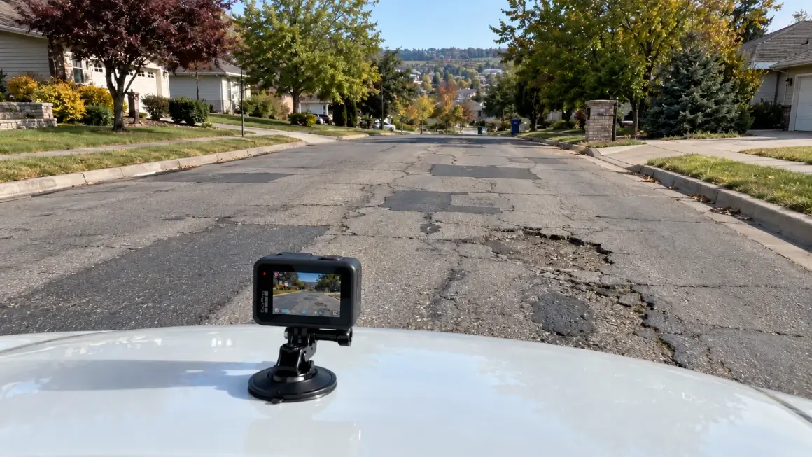
Mount a GPS-enabled GoPro camera to a survey vehicle windshield, bumper, or inspection pole. Drive target road corridors at standard speeds while the camera logs continuous spatial telemetry alongside high-definition video.
Extract Telemetry Locally in Your Browser
Open maps.video on your workstation or field laptop and drag in the GoPro MP4 file. Embedded spatial telemetry is parsed instantly on your local device—no cloud processing or high-bandwidth video uploads required.
Extract & Share Stamped Frame Proofs
Click any point along the rendered route map to instantly jump the video to that exact location. Extract high-resolution, time- and location-stamped video frames to email directly to clients or attach to PDF survey reports.
Core Technical Capabilities for Road Survey Software
Instant Local Telemetry Extraction
GoPro action cameras embed high-frequency GPS metadata directly within raw MP4 video streams. Maps.video parses this telemetry locally inside your web browser without sending video data to external servers.
- Eliminate cloud video storage fees and recurring hosting charges.
- Preserve field cellular bandwidth on rural or remote road surveys.
- Maintain strict data security by keeping all raw video on internal drives.
Click-to-Coordinate Human Review
By bypassing automated AI crack detection, maps.video delivers a ultra-fast manual review workflow. The interactive vector map links directly to the video player for synchronized playback.
- Inspect specific potholes, pavement joins, or signage instantly.
- Correlate physical road distress with exact GPS geographic coordinates.
- Eliminate time wasted reviewing AI false positives caused by shadows or debris.
KML/KMZ & Esri Engineering Layer Overlays
Import municipal street centerlines, parcel boundaries, or highway stationing files directly into the map view to compare recorded paths against official GIS records.
- Overlay KML/KMZ vector files onto the interactive survey route map.
- Toggle Esri high-resolution satellite basemaps via native ArcGIS integration.
- Verify full survey coverage across required road network boundaries.
Stamped Frame Deliverables (No Hosted Links)
Maps.video does not generate shareable cloud web links. Instead, you extract stamped video frames containing burned-in GPS coordinates, date, and timestamp data.
- Export clean, geotagged image frames with a single click.
- Attach stamped frames directly into PDF pavement management logs.
- Email proof images directly to municipal engineers or clients without login friction.

Road Survey Software Workflow Comparison
How maps.video compares to traditional photo logs and complex AI survey platforms
| Documentation Feature | Traditional Photo Logs | Legacy Cloud / AI Software | Maps.video Platform |
|---|---|---|---|
| Hardware Requirement | Smartphones / Cameras | Proprietary Profilers / Scanners | GoPro Action Cameras Only (Built-in GPS) |
| Analysis & Detection Model | Manual image sorting | Automated AI Crack Detection | Fast Manual Human Review (Zero AI False Positives) |
| Data Processing & Storage | Manual folder structure | Heavy cloud video uploads | 100% Local In-Browser Processing (Zero Uploads) |
| Deliverable Sharing Method | Loose Unorganized JPEGs | Cloud Portal Subscription Links | Export Geotagged Stamped Frames (Email / PDF) |
| Spatial Track Precision | Low (Isolated JPEG pins) | Variable (Cloud processing) | Continuous GoPro GPS Path Synchronization |
| Review Speed & Accuracy | Slow (Searching folders) | Medium (Re-verifying AI errors) | Ultra-Fast (Click route point & export frame) |
Eliminating Software Lock-In & Accelerating Road Audits
Overpaying for complex AI subscriptions drains limited public works and highway maintenance budgets that could otherwise fund physical asphalt resurfacing and repairs.
Traditional AI / Cloud Survey Software Cycle
Expensive AI Software Subscription ➔ Slow Video Upload Queues ➔ AI False Positive Filtering ➔ Expiring Cloud Links ➔ High Per-Mile Cost
Maps.video Streamlined GoPro Workflow
Standard GoPro Camera ➔ Instant Local Browser Telemetry ➔ Fast Human Visual Review ➔ Stamped Frame Reports ➔ Zero Cloud Fees
By adopting a browser-based, local-first road survey workflow with maps.video:
- Dramatically Reduce Software Costs: Eliminate monthly recurring AI software licenses and expensive per-mile processing fees.
- Accelerate Submittal Timelines: Process miles of road footage locally on the same day it is captured, without waiting for cloud rendering queues.
- Ensure Long-Term Archival Access: Maintain complete control over your raw video data stored locally, while exporting clean, white-labeled frame proofs for permanent project records.
Frequently Asked Questions
Everything you need to know about local GoPro GPS extraction and manual road survey software deliverables
Q: Does maps.video include automated AI crack detection or PCI scoring?
A: No. Maps.video is specifically designed as a fast, cost-effective manual visual review tool. It intentionally excludes automated AI crack detection or machine-learning distress classification, avoiding expensive AI subscription fees and false-positive errors caused by shadows or debris.
Q: Why does maps.video require GoPro cameras exclusively?
A: GoPro action cameras feature robust, high-frequency internal GPS receivers that embed accurate spatial telemetry directly inside standard MP4 video streams. This enables maps.video to parse spatial tracks directly from the camera file without requiring external GPS loggers or custom hardware.
Q: Does maps.video create shareable video links?
A: No. Maps.video operates on a local-first browser model and does not upload video files to cloud servers or host footage online. There are no shareable video links. All raw video remains securely stored on your local workstation or company network drive.
Q: How do clients, city engineers, or inspectors review survey findings?
A: You extract high-definition, geotagged video frames directly from key points along the map track. These stamped image frames feature burned-in GPS coordinates, dates, and timestamps, making them easy to email directly to stakeholders or attach to standard PDF road condition reports.
Q: Is a fast internet connection required to perform road surveys in the field?
A: No. Because telemetry extraction and map synchronizations occur locally inside your web browser, maps.video can process recorded GoPro video files on field laptops without uploading raw video over mobile networks.
Q: Can I overlay municipal CAD or GIS road alignments on the survey map?
A: Yes. Maps.video supports standard KML and KMZ spatial files. You can overlay municipal street centerlines, parcel boundaries, or right-of-way limits directly on top of your interactive video route map alongside Esri high-resolution satellite imagery.
Built for Highway Engineers, Civil Contractors, and Public Works Directors
Integrating seamlessly into daily road maintenance and inspection workflows using standard GoPro hardware
For Highway Maintenance Engineers
Maintain continuous visual oversight of road corridors, pavement conditions, and roadside assets without spending days manually sorting loose smartphone photographs.
For Paving & Civil Contractors
Build an unassailable baseline of existing pavement quality prior to mobilization, and generate geotagged frame proof to confirm final surface restoration for rapid permit closure.
For Municipal Public Works Directors
Deliver clear, location-stamped visual audit packages to city councils and funding agencies while allocating public funds toward physical road repairs rather than expensive AI software fees.
"The maps.video local application has made it really easy to access and control HD video playback... It's allowed me to create a fully mapped video library of a city or town's road network using hardware (GoPro cameras) that I already owned."
Upgrade Your Road Survey Workflow Today
Stop paying thousands for complex AI software you don't need. Experience fast, practical, browser-based GoPro road mapping and build an indisputable visual record of your road network.
Test maps.video with Sample Footage