
Instant GoPro GPS Telemetry & Map Overlay Alternative
Without Long Desktop Renders
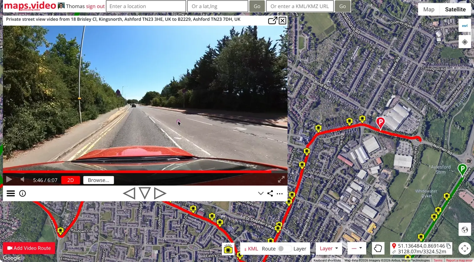
Tired of waiting 45 minutes for legacy software to burn static map graphics onto MP4s? Extract GoPro GPS telemetry instantly in your browser and get shareable, interactive video maps in seconds.
The application was intuitive to use and displayed exactly the kind of information we needed to show to our clients. It was very convenient not having to download additional software on the user or client side. Whenever video roadway survey work comes along, we know who to turn to!
— Donovan Bradshaw, Lead Geotechnical Engineer

Loved it. Having worked with it the past few months with a few guys, it’s been very easy to work with. With the amount of video files we have, all we need to have is an external hard drive plugged in and that’s it. Earlier this week, we sat down with the town to show them the work we’ve done, and they loved it as well
. — Victor Zhang, PE Sr. Structural/Bridge Engineer
The maps.video local application has made it really easy to access and control HD video playback, which has made determining the location of roadway features very efficient. It’s allowed me to create a fully mapped video library of a city or town’s road network using hardware (GoPro cameras) that I already owned.
— Lance Baden, Consultant

The application was intuitive to use and displayed exactly the kind of information we needed to show to our clients. It was very convenient not having to download additional software on the user or client side. Whenever video roadway survey work comes along, we know who to turn to!
— Donovan Bradshaw, Lead Geotechnical Engineer
Loved it. Having worked with it the past few months with a few guys, it’s been very easy to work with. With the amount of video files we have, all we need to have is an external hard drive plugged in and that’s it. Earlier this week, we sat down with the town to show them the work we’ve done, and they loved it as well
. — Victor Zhang, PE Sr. Structural/Bridge Engineer
The maps.video local application has made it really easy to access and control HD video playback, which has made determining the location of roadway features very efficient. It’s allowed me to create a fully mapped video library of a city or town’s road network using hardware (GoPro cameras) that I already owned.
— Lance Baden, Consultant
Why Contractors & Engineers Are Replacing Desktop Overlays
Stop wasting hours rendering static MP4 video gauges. Upgrade to instant interactive spatial video mapping
| Feature / Metric | Traditional Desktop Overlays | Maps.video Local Video Player |
|---|---|---|
| Processing Speed | 30 to 60 minutes per video file | Instant (Browser-based extraction) |
| System Resources | Heavy CPU/GPU load, fans spinning, desktop locked up | Zero video rendering; runs smoothly in-browser |
| Map Interactivity | Static graphic burned onto video pixels (Unclickable) | Click any route point to jump video to frame instantly |
| Client & Team Sharing | Re-uploading heavy multi-gigabyte MP4 files | Single private or public shareable web link |
| Enterprise GIS Integration | None (Requires manual export/import steps) | ArcGIS SSO, Esri Basemaps, and KML/KMZ exports |
Built for Paving, Infrastructure & Utility Teams
Everything you need for field proof-of-work, site inspections, and asset management
Batch GoPro GPS Extraction
Process dozens or hundreds of GoPro MP4, .360 files simultaneously. Automatically stitch chapters without joined rendering.
Frame Extraction & Photo POIs
Scrub to exact video frames, click a single button to extract a high-res JPEG, and drop a geolocated photo pin directly on the map.
Esri ArcGIS & Google Maps
Toggle seamlessly between Google Maps and Esri basemaps. Sign in with ArcGIS SSO to align video footage with corporate GIS data.
Private Team Workspaces
Keep sensitive infrastructure, pipeline undergrounding, and road survey footage fully private and restricted to authorized team members.
KML & GIS Data Export
Export fully mapped video route tracks and extracted POI photos directly to KML/KMZ formats for loading into Google Earth or ArcGIS.
GoPro Max 360° Support
Full native support for GoPro Max 1 and 2 spherical video playback with interactive drag-to-pan spatial controls.
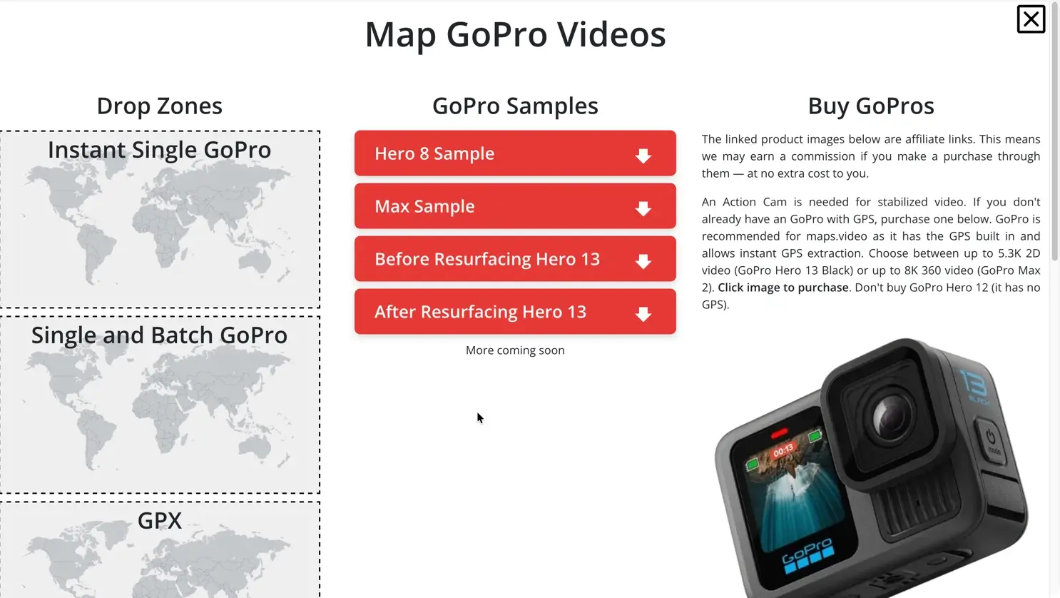
Use Our GoPro Samples If You Don't Have Any
and experience instant GoPro video mapping
"The maps.video local application has made it really easy to access and control HD video playback... It's allowed me to create a fully mapped video library of a city or town's road network using hardware (GoPro cameras) that I already owned."
Ready to Map Your GoPro Videos Instantly?
No credit card required for GPS visualization. Works natively with GoPro HERO13, HERO11, HERO10, HERO9, HERO8, MAX1, MAX2, and GPX files.
Start Video Mapping Free