
Street Works Reinstatement GPS Video Mapping & SROH Proof-of-Work
Eliminate Section 74 overrun fines, prove SROH compliance, and map miles of utility trenching and highway reinstatement—without uploading raw video.
The application was intuitive to use and displayed exactly the kind of information we needed to show to our clients. It was very convenient not having to download additional software on the user or client side. Whenever video roadway survey work comes along, we know who to turn to!
— Donovan Bradshaw, Lead Geotechnical Engineer

Loved it. Having worked with it the past few months with a few guys, it’s been very easy to work with. With the amount of video files we have, all we need to have is an external hard drive plugged in and that’s it. Earlier this week, we sat down with the town to show them the work we’ve done, and they loved it as well
. — Victor Zhang, PE Sr. Structural/Bridge Engineer
The maps.video local application has made it really easy to access and control HD video playback, which has made determining the location of roadway features very efficient. It’s allowed me to create a fully mapped video library of a city or town’s road network using hardware (GoPro cameras) that I already owned.
— Lance Baden, Consultant

The application was intuitive to use and displayed exactly the kind of information we needed to show to our clients. It was very convenient not having to download additional software on the user or client side. Whenever video roadway survey work comes along, we know who to turn to!
— Donovan Bradshaw, Lead Geotechnical Engineer
Loved it. Having worked with it the past few months with a few guys, it’s been very easy to work with. With the amount of video files we have, all we need to have is an external hard drive plugged in and that’s it. Earlier this week, we sat down with the town to show them the work we’ve done, and they loved it as well
. — Victor Zhang, PE Sr. Structural/Bridge Engineer
The maps.video local application has made it really easy to access and control HD video playback, which has made determining the location of roadway features very efficient. It’s allowed me to create a fully mapped video library of a city or town’s road network using hardware (GoPro cameras) that I already owned.
— Lance Baden, Consultant
Utility contractors and highway reinstatement teams working under the New Roads and Street Works Act (NRSWA) face aggressive inspection regimes, strict permit windows, and severe financial penalties for non-compliance. Delivering interim and permanent reinstatements in full alignment with the Specification for the Reinstatement of Openings in Highways (SROH) requires granular, indisputable proof at every operational stage.
When highway authority inspectors issue defect notices, question compaction lift thickness, or levy Section 74 overrun charges, loose mobile photos and paper site logs fail to defend your team. Traditional highway documentation methods cause heavy administrative friction:
- Dislocated Field Photos: Taking separate photos creates spatial gaps, lacks clear chainage context, and makes submitting required visual evidence to Street Manager messy and disjointed.
- Unverifiable Subsurface Reinstatement: Proving proper sub-base compaction, edge saw-cutting, tack coat application, and bituminous layer depths becomes impossible once the surface course is rolled flat.
- Bandwidth & Cloud Storage Bottlenecks: Recording hours of high-definition video along job corridors creates multi-gigabyte files. Uploading raw video over field cellular networks is costly, slow, and impractically CPU-heavy.
maps.video solves this core friction. By processing embedded GoPro GPS telemetry directly within your browser, field teams instantly link video to interactive map routes locally. When evidence is required, you simply extract stamped, geotagged video frames corresponding to specific map coordinates to upload directly to Street Manager or attach to compliance logs.

Key Street Works & SROH Inspection Phases Supported
Statutory street works compliance requires verifiable visual proof across every excavation, backfill, and surfacing phase before permit closure.
Excavation & Backfill Verification
- Pre-Existing Site Audit: Record baseline highway, footway, and kerb conditions prior to breaking ground.
- Trench Depth & Utility Clearance: Document excavation depth, pipe/cable surround, and warning tape placement.
- Backfill & Sub-Base QA: Log granular sub-base layer thickness, type, and mechanical compaction passes.
Surface Reinstatement & SROH QA
- Edge Trim & Tack Coat: Capture clear visual proof of clean saw-cut edges and uniform bitumen edge spraying.
- Binder & Wearing Course: Document hot-lay asphalt temperatures, layer thicknesses, and surface compaction.
- Site Clearout & Kerbs: Verify site clearance, kerb stone reinstatement, and road marking replacement.
- Defend Against Section 74 Fines: Eliminate unjust daily overrun charges by exporting timestamped video frames proving exact site clearance and traffic management removal times.
- Halt SROH Defect Claims: Maintain an unassailable visual archive proving correct compaction materials and edge sealing prior to site sign-off.
How maps.video Works for Street Works Operations
Continuous video mapping and local proof-of-work extraction from GoPro cameras directly inside your web browser
Works with GoPro HERO13, HERO11, HERO10, HERO9, HERO8, HERO7, HERO6, HERO5, MAX2, MAX, Fusion, Session 5 and .gpx.
Record Operations with GoPro Hardware
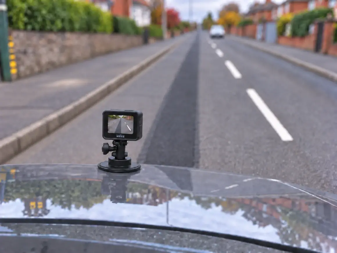
Mount a GPS-equipped GoPro to a vehicle, reinstatement rig, or survey pole. Capture continuous video along the excavated trench, backfill pass, or finished asphalt reinstatement.
Extract Telemetry Locally in Browser
Open maps.video on your field laptop. Drag and drop the GoPro video file directly into the browser window. Telemetry is parsed instantly—no video files are uploaded over cellular connections.
Extract & Share Stamped Frame Proofs
Click key inspection points along the map line to extract stamped, geotagged video frames. Attach these proof-of-work images directly into Street Manager submissions and daily sign-off logs.
Core Technical Capabilities for Highway Contractors
Instant Local Telemetry Extraction
GoPro cameras log spatial metadata alongside video streams. Traditional platforms require heavy cloud uploads, but maps.video extracts GPS tracks instantly on your local device.
- Preserve mobile cellular data on active highway job sites.
- Eliminate cloud processing queues and rendering delays.
- Maintain total data privacy by keeping raw footage local.
Click-to-Coordinate Inspection
The local interface pairs an interactive vector map directly alongside your video player. Moving along the map route jumps the video player directly to that exact spot.
- Inspect exact permit boundaries, kerb lines, and joint edges.
- Verify edge spraying and compaction across long linear trenches.
- Extract geotagged video frames marked with precise GPS telemetry.
KML/KMZ & Esri Engineering Overlays
Upload permit boundaries, CAD alignments, or GIS spatial files directly into the map view to compare planned works against actual field routes.
- Confirm work remains strictly within authorized permit boundaries.
- Toggle Esri basemaps via ArcGIS integration for satellite context.
- Verify utility positioning against local authority highway records.
White-Labeled Deliverables
Highway authority inspectors and client auditors do not need software accounts or cloud logins to verify your work.
- Download GPS-stamped frames tied directly to map route locations.
- Exclusion of software vendor branding maintains total brand identity.
- Attach stamped photo evidence directly to Street Manager compliance reports.

Street Works Documentation Workflow Comparison
How maps.video compares to traditional photo logs and unmapped video files
| Documentation Feature | Traditional Photo Logs | Standard Video Files | maps.video Platform |
|---|---|---|---|
| Spatial Precision | Low (Isolated JPEG pins) | None (Single file tag) | Continuous GoPro GPS Path Linking |
| Data Workflow | Manual image naming | High-bandwidth cloud uploads | Browser-Based Local Telemetry Extraction |
| Coverage Continuity | Spotty (Gaps between photos) | Continuous (Hard to navigate) | 100% Continuous & Map-Synchronized |
| Inspector Verification Time | High (Manual folder search) | High (Scrubbing long videos) | Ultra-Fast (Click route point & export frame) |
| Design Layer Integration | Static PDF overlays | No map integration | Interactive KML/KMZ & Esri Basemaps |
Eliminating Overrun Fines & Speeding Up Permit Closures
Highway authorities issue heavy Section 74 penalties and hold back sign-offs over unverified reinstatement quality or timing disputes.
Traditional Dispute & Sign-Off Cycle (20–60 Days)
Reinstatement Completed ➔ Section 74 / Defect Notice Issued ➔ Manual Re-Inspections ➔ Bureaucratic Appeals ➔ Fines Paid or Delayed Sign-off
maps.video Sign-Off Cycle (1–2 Days)
Reinstatement Completed ➔ Local GoPro GPS Extraction (Same Day) ➔ Export Stamped Frame Proofs (Same Day) ➔ Rapid Permit Closure
By switching from unorganized photos to local GPS video mapping:
- Defend Against Section 74 Charges: Export timestamped, geotagged video frames proving exact site clearance and road re-opening hours.
- Prove SROH Compliance: Maintain a permanent, timestamped visual record of pre-existing highway defects, edge tacking, and hot asphalt placement.
- Keep Subcontractors Accountable: Confirm daily linear progress, reinstatement quality, and cleanup across all field teams.
Frequently Asked Questions
Everything you need to know about local GoPro GPS extraction and SROH street works deliverables
Q: What camera equipment is required for street works mapping?
A: maps.video is optimized specifically for GoPro action cameras with built-in GPS telemetry (such as GoPro HERO models).
Q: Does maps.video upload my video footage to cloud servers?
A: No. The platform operates on a local-first architecture. GPS data extraction and map synchronization occur completely within your local web browser, preserving cellular bandwidth on job sites.
Q: How do highway inspectors review proof of work without shareable links?
A: You can export timestamped and geotagged video frames directly from specific points along the map line. These stamped image deliverables can be emailed or uploaded directly to Street Manager and daily inspection logs.
Q: Can I customize deliverables with my company branding?
A: Yes. maps.video supports clean, white-labeled exports that display your project data while excluding software vendor branding.
Built for Utility Contractors, Reinstatement Crews, and Street Works Managers
Integrating seamlessly into daily field operations using off-the-shelf GoPro hardware
For Street Works Supervisors & Agents
Maintain complete oversight across multiple active permits without driving between sites. Review daily video runs on interactive map overlays to verify site clearance.
For Compliance & Quality Managers
Build an unassailable SROH compliance archive. Verify saw-cutting, bitumen edge sealing, and asphalt compaction against statutory specifications.
For Commercial Managers & Quantity Surveyors
Protect margins against unjustified Section 74 overrun fines and client retentions by delivering indisputable geotagged frame evidence.
"The maps.video local application has made it really easy to access and control HD video playback... It's allowed me to create a fully mapped video library of a city or town's road network using hardware (GoPro cameras) that I already owned."
Upgrade Your Highway Reinstatement Documentation Today
Stop relying on fragmented photos and unverified reports to document critical street works. Elevate your compliance standards, eliminate overrun fines, and build an unassailable record of your work.
Test maps.video with Sample Footage