
Gas Pipeline Trenching GPS Video Mapping & Proof-of-Work
Eliminating Compliance Friction, Trenching Disputes, and Unverifiable Proof-of-Work in Gas Utility Infrastructure
The application was intuitive to use and displayed exactly the kind of information we needed to show to our clients. It was very convenient not having to download additional software on the user or client side. Whenever video roadway survey work comes along, we know who to turn to!
— Donovan Bradshaw, Lead Geotechnical Engineer

Loved it. Having worked with it the past few months with a few guys, it’s been very easy to work with. With the amount of video files we have, all we need to have is an external hard drive plugged in and that’s it. Earlier this week, we sat down with the town to show them the work we’ve done, and they loved it as well
. — Victor Zhang, PE Sr. Structural/Bridge Engineer
The maps.video local application has made it really easy to access and control HD video playback, which has made determining the location of roadway features very efficient. It’s allowed me to create a fully mapped video library of a city or town’s road network using hardware (GoPro cameras) that I already owned.
— Lance Baden, Consultant

The application was intuitive to use and displayed exactly the kind of information we needed to show to our clients. It was very convenient not having to download additional software on the user or client side. Whenever video roadway survey work comes along, we know who to turn to!
— Donovan Bradshaw, Lead Geotechnical Engineer
Loved it. Having worked with it the past few months with a few guys, it’s been very easy to work with. With the amount of video files we have, all we need to have is an external hard drive plugged in and that’s it. Earlier this week, we sat down with the town to show them the work we’ve done, and they loved it as well
. — Victor Zhang, PE Sr. Structural/Bridge Engineer
The maps.video local application has made it really easy to access and control HD video playback, which has made determining the location of roadway features very efficient. It’s allowed me to create a fully mapped video library of a city or town’s road network using hardware (GoPro cameras) that I already owned.
— Lance Baden, Consultant
Gas pipeline trenching demands an uncompromising level of documentation, regulatory compliance, and positional accuracy. Whether laying high-pressure steel transmission mains, upgrading distribution networks with polyethylene (PE) piping, or executing service line connections, gas contractors operate under intense scrutiny. Federal safety standards, municipal code requirements, and environmental regulations mandate comprehensive visual and spatial proof of installation before backfilling can occur.
Historically, documenting an open-trench installation required field technicians to pause work, walk the line, take hundreds of disconnected photos, manually record GPS coordinates, and attempt to cross-reference timestamps with paper logs or CAD layers. This workflow is fundamentally broken. Critical details—such as trench depth context, pipe condition, trace wire placement, warning tape positioning, and exact bedding material—are frequently missed, poorly documented, or lost in fragmented camera rolls.
maps.video transforms how gas pipeline trenching is documented, verified, and audited. By combining high-definition GoPro video capture with continuous, high-precision GPS telemetry, maps.video turns standard field video into an interactive, spatial map interface. Stakeholders can click any point directly on the GPS path to immediately jump to the exact video frame captured at that specific location.

The Gas Pipeline Trenching Reality: High Stakes, Hidden Risks
Documenting gas infrastructure is distinct from other utility trenching projects due to the volatile nature of the product and strict safety regulations. Once backfilled, visual access to the asset is lost forever—unless you have a frame-by-frame, spatially anchored visual record.
- The "Invisible Asset" Liability: Once backfilling begins, verifying warning ribbon offset or rock shield positioning requires unearthing the pipe—a costly, high-risk endeavor.
- Manual Photo Tagging Bottlenecks: Field engineers waste hours taking static photos, naming files, and creating PDFs to match coordinates to GIS maps.
- Disputed Depth of Cover Claims: Local authorities and prime contractors frequently challenge depth compliance. Static photos rarely provide continuous context.
- Complex As-Built Handover Protocols: Gas utilities require precise location data before accepting new infrastructure into GIS systems.
- Third-Party Damage Disputes: When third-party excavators hit a pipeline years later, having continuous visual proof of original trench conditions protects against liability.
How maps.video Works for Gas Operations
Continuous video mapping and work proof from GoPro action cameras directly inside your web browser
Works with GoPro HERO13, HERO11, HERO10, HERO9, HERO8, HERO7, HERO6, HERO5, MAX2, MAX, Fusion, Session 5 and .gpx.
Capture the Trench in Real Time
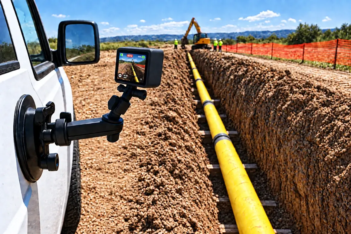
Field crews walk, ride, or mount a GoPro camera to an excavator as the trench is cut, pipe is laid, or bedding is placed. GPS data is logged continuously by the camera during recording.
Instant Local GPS Extraction
Process the video locally in your browser. maps.video extracts the raw GPS telemetry from the file metadata and links it directly to the interactive map interface—no heavy video uploading required.
Interactive Visual Inspection
Managers, inspectors, and utility auditors click anywhere on the mapped GPS path to instantly jump to that exact frame in the video feed, allowing rapid inspection of pipe conditions and warning tape placement.
Core Features Tailored for Gas Trenching Documentation
Geo-Tagged Timestamping
Every point on your mapped GPS path links directly to the corresponding timestamp and location coordinates from your GoPro telemetry.
- Verify fuse welds and mechanical joints before backfilling.
- Prove proper placement of tracer wire and warning tape.
- Maintain accurate compliance records for safety regulations.
Click-to-Location Playback
Stop toggling between separate GIS viewers and image folders. Work with a side-by-side view showing an interactive map interface alongside your video player.
- Click directly on the GPS path to jump instantly to that spot in the recording.
- Inspect trench walls and soil consistency while viewing exact map location.
- Review continuous footage across long linear stretches without scrub delays.
Permalinks for Direct Access
Eliminate massive PDF reports and zip files of unorganized images. Use permalinks to mapped videos to quickly direct team members and clients to exact segments.
- Provide direct permalinks to specific video-mapped segments.
- Accelerate progress payment approvals from utility operators.
- Maintain organized, accessible visual proof for regulatory archives.
KML/KMZ & Esri Basemaps
Integrate standard spatial layers and specialized map views directly within the maps.video interface.
- Overlay KML/KMZ boundary or alignment files onto the map view.
- Toggle Esri basemaps via ArcGIS integration for high-res satellite layers.
- Identify unmapped existing utilities discovered during excavation.

Gas Pipeline Documentation Workflow Comparison
How maps.video compares to traditional photo logging and raw video files
| Documentation Feature | Traditional Photo Logs | Standard Video Files | maps.video Platform |
|---|---|---|---|
| Spatial Precision | Low (Isolated GPS pins) | None (Single location tag) | Continuous GoPro GPS Path Linking |
| Data Workflow | Manual file sorting | High bandwidth video uploads | Browser-Based Local Telemetry Extraction |
| Coverage Continuity | Spotty (Gaps between photos) | Continuous (Hard to locate points) | 100% Continuous & Instantly Clickable |
| Inspector Review Time | High (Searching through folders) | High (Scrubbing long videos) | Ultra-Fast (Click point on GPS path) |
| Map Base Options | Standard web maps | No map integration | KML/KMZ Overlays & Esri Basemaps |
Built for GoPro Field Workflows, Civil Engineers, and Utility Operators
Integrating directly into your field workflow using standard GoPro hardware
For Field Superintendents
Eliminate hours spent double-checking whether crews captured essential trench footage. Simply walk or ride the line with a GoPro camera once before backfilling.
For Quality Control Officers
Perform detailed, remote virtual site inspections of every foot of pipe laid without traveling to every active site location.
For Project Managers
Protect margins against claims, liquidated damages, and disputed change orders regarding subsurface conditions or restoration specifications.
"The maps.video local application has made it really easy to access and control HD video playback... It's allowed me to create a fully mapped video library of a city or town's road network using hardware (GoPro cameras) that I already owned."
Streamline Your Pipeline Compliance Today
Stop relying on fragmented photos and unverified reports to document critical gas infrastructure. Elevate your documentation standards, speed up client approvals, and build an unassailable record of your work.
Test maps.video with Sample Footage