
Pre-Existing Damage Defense GPS Video Mapping & Geotagged Proof
Shield civil contractors, utilities, and heavy excavators against false third-party claims, unearned property damage liability, and disputed retainage—without uploading raw video.
The application was intuitive to use and displayed exactly the kind of information we needed to show to our clients. It was very convenient not having to download additional software on the user or client side. Whenever video roadway survey work comes along, we know who to turn to!
— Donovan Bradshaw, Lead Geotechnical Engineer

Loved it. Having worked with it the past few months with a few guys, it’s been very easy to work with. With the amount of video files we have, all we need to have is an external hard drive plugged in and that’s it. Earlier this week, we sat down with the town to show them the work we’ve done, and they loved it as well
. — Victor Zhang, PE Sr. Structural/Bridge Engineer
The maps.video local application has made it really easy to access and control HD video playback, which has made determining the location of roadway features very efficient. It’s allowed me to create a fully mapped video library of a city or town’s road network using hardware (GoPro cameras) that I already owned.
— Lance Baden, Consultant

The application was intuitive to use and displayed exactly the kind of information we needed to show to our clients. It was very convenient not having to download additional software on the user or client side. Whenever video roadway survey work comes along, we know who to turn to!
— Donovan Bradshaw, Lead Geotechnical Engineer
Loved it. Having worked with it the past few months with a few guys, it’s been very easy to work with. With the amount of video files we have, all we need to have is an external hard drive plugged in and that’s it. Earlier this week, we sat down with the town to show them the work we’ve done, and they loved it as well
. — Victor Zhang, PE Sr. Structural/Bridge Engineer
The maps.video local application has made it really easy to access and control HD video playback, which has made determining the location of roadway features very efficient. It’s allowed me to create a fully mapped video library of a city or town’s road network using hardware (GoPro cameras) that I already owned.
— Lance Baden, Consultant
Executing heavy civil earthworks, utility trenching, directional drilling, structural demolition, or road resurfacing inevitably subjects nearby structures and public infrastructure to vibration, ground movement, and heavy equipment traffic. Adjacent property owners, local businesses, and municipal authorities frequently allege that construction activity caused foundation cracking, driveway subsidence, damaged retaining walls, or fractured kerbs. Defending against unearned property damage claims requires establishing an airtight, spatially continuous visual baseline prior to breaking ground.
When third-party property owners or municipal highway inspectors submit costly damage claims, traditional field documentation falls short. Relying on disorganized mobile phone photos and vague hand-written site logs leaves general contractors exposed to unjustified insurance payouts and withheld retainage. Standard pre-construction documentation methods create severe friction for risk management teams:
- Dislocated Field Photos: Taking hundreds of individual smartphone photos leaves massive spatial gaps along project boundaries. When a building owner claims a foundation crack was caused by your excavator, isolated photos rarely capture that specific wall at the right angle with verifiable stationing.
- Unverifiable Baseline Dates & Locations: Photos stored in fragmented camera rolls lack embedded, immutable spatial coordinates and verifiable context. Claim adjusters and opposing legal counsel easily challenge unanchored static images.
- Massive Video Upload & Storage Bottlenecks: Recording hours of high-definition corridor or site perimeter video produces massive multi-gigabyte files. Attempting to upload raw video over mobile field connections is painfully slow, expensive, and impractical.
maps.video solves this core risk. Optimized exclusively for GoPro action cameras with built-in GPS, our platform processes telemetry data locally within your web browser. Rather than relying on cloud hosting or shareable video links, maps.video enables field teams to instantly extract time-stamped, geotagged video frames from any point along a mapped route. These stamped frame exports can be emailed directly to insurance adjusters, attached to daily site logs, or compiled into legal defense submittals.

High-Stakes Liability Risks: The Cost of Unverified Claims
Construction insurance deductibles and third-party property claims can erase profit margins on civil projects. maps.video provides continuous visual coverage across all primary risk zones.
Private Property & Boundary Audits
- Foundation & Wall Cracks: Document baseline stucco, brick mortar, and concrete foundation cracks prior to pile driving or compaction.
- Driveways & Walkways: Capture existing concrete spalling, asphalt rutting, and stone displacement along access routes.
- Retaining Walls & Fences: Log pre-existing structural lean, fence damage, and boundary wall instability.
Public Highway & Utility Corridors
- Kerbs & Footways: Record cracked kerb stones, sunken flagstones, and damaged asphalt adjacent to the excavation zone.
- Utility Ironwork & Covers: Log pre-existing fractures on manhole frames, valve boxes, and catch basin grates.
- Adjacent Pavement Distress: Map baseline alligator cracking, potholes, and joint separation on surrounding roadways.
- Refute False Property Damage Claims: Reject third-party compensation claims instantly by extracting stamped, geotagged video frames proving defects existed before site mobilization.
- Protect Project Retainage: Prevent municipalities and private developers from holding back final payments over pre-existing infrastructure defects.
- Reduce Insurance Deductible Losses: Provide claims adjusters with indisputable visual proof, preventing payout of frivolous third-party claims against your policy.
How maps.video Works for Damage Defense
Continuous video mapping and local proof-of-work extraction from GoPro cameras directly inside your web browser
Works with GoPro HERO13, HERO11, HERO10, HERO9, HERO8, HERO7, HERO6, HERO5, MAX2, MAX, Fusion, Session 5 and .gpx.
Record Baselines with GoPro Hardware
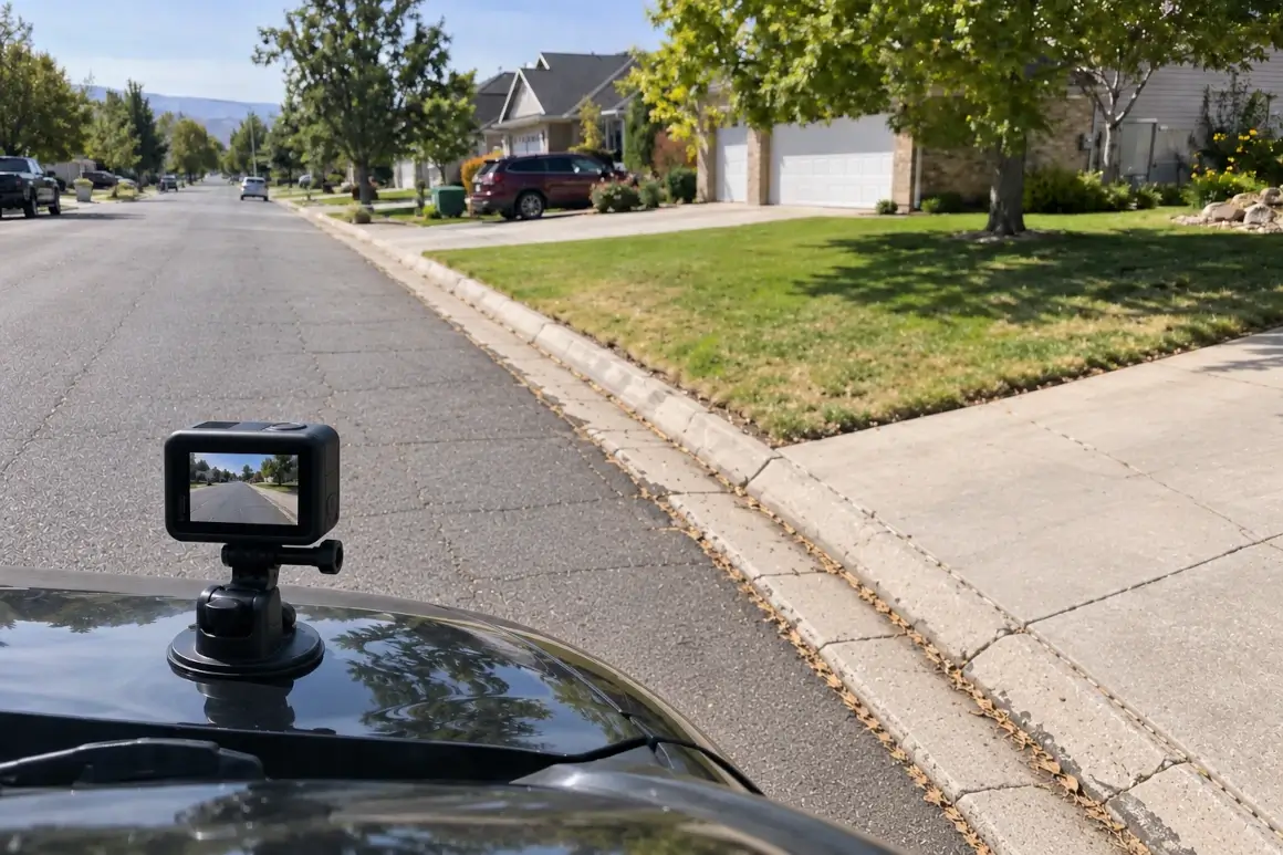
Mount a GPS-equipped GoPro camera to a survey vehicle, walking pole, or site helmet. Drive or walk the project boundary, haul route, or adjacent properties before breaking ground.
Extract Telemetry Locally in Browser
Open maps.video on your field laptop or desktop. Drag and drop the raw GoPro video file directly into the browser. Telemetry is parsed locally and instantly mapped—no video files are uploaded to cloud servers.
Extract & Share Stamped Frame Proofs
Click any point along the mapped GPS route to jump to that exact frame. Extract geotagged, time-stamped frame images to email directly to adjusters, attach to daily logs, or include in legal defense packages.
Core Technical Capabilities for Risk & Legal Defense
Geo-Tagged Timestamped Proof
Every extracted video frame features an immutable overlay showing precise GPS coordinates, elevation, speed, date, and exact time from your GoPro's internal satellite receiver.
- Establish undeniable proof of baseline conditions prior to site work.
- Verify precise stationing along extended utility or road corridors.
- Create court-admissible visual evidence for dispute resolution.
Click-to-Coordinate Inspection
The local interface pairs an interactive vector map directly alongside your video player. Scrubbing or clicking anywhere on the mapped GPS line instantly moves the video to that exact location.
- Locate specific property addresses or station numbers in seconds.
- Inspect subtle wall hairline cracks, kerb chips, or pavement defects.
- Review miles of continuous perimeter footage without scrub delays.
Local-First Browser Extraction
Traditional video mapping services require uploading multi-gigabyte files to cloud servers. maps.video processes everything locally on your computer using WebAssembly technology.
- Eliminate cloud storage subscription costs and processing queues.
- Preserve field cellular data bandwidth on remote project sites.
- Maintain 100% data privacy by keeping raw footage stored locally.
KML/KMZ & Esri Basemaps
Overlay project design boundaries, right-of-way lines, or easement files directly into the maps.video interface alongside high-resolution Esri satellite imagery.
- Verify whether alleged damage falls within or outside project limits.
- Toggle satellite basemaps via ArcGIS integration for spatial context.
- Cross-reference parcel boundaries with pre-construction survey paths.

Pre-Existing Damage Documentation Workflow Comparison
How maps.video compares to traditional photo logs and unmapped video files
| Documentation Feature | Traditional Photo Logs | Standard Video Files | maps.video Platform |
|---|---|---|---|
| Spatial Precision | Low (Isolated JPEG pins) | None (Single file tag) | Continuous GoPro GPS Path Linking |
| Data Workflow | Manual image naming & sorting | High-bandwidth cloud uploads | Browser-Based Local Telemetry Extraction |
| Coverage Continuity | Spotty (Gaps between photos) | Continuous (Hard to locate points) | 100% Continuous & Instantly Clickable |
| Claim Defense Speed | Slow (Searching photo folders) | Slow (Manual video scrubbing) | Ultra-Fast (Click map point & export frame) |
| Deliverables Format | Loose images or heavy PDFs | Massive raw MP4 files | GPS-Stamped Frames for Direct Email & Reports |
Protecting Cash Flow & Resolving Claims Same-Day
Third-party claims and municipal disputes over pre-existing road or structural defects can freeze project retainage for months.
Traditional Claim Dispute Cycle (30–90 Days)
Third-Party Claim Submitted ➔ Disputed Pre-Existing Defect ➔ Manual Field Re-Inspections ➔ Adjuster & Legal Disputes ➔ Retainage Withheld / Deductible Paid
maps.video Defense Cycle (Same Day)
Third-Party Claim Submitted ➔ Open Mapped Local GoPro Survey (1 Min) ➔ Export Geotagged Baseline Frame ➔ Immediate Claim Rejection
By switching from unorganized photos to local GoPro GPS video mapping:
- Refute Unjustified Damage Claims: Instantly export timestamped, geotagged video frames proving that foundation, wall, or driveway damage existed before work commenced.
- Protect Project Retainage: Prevent local authorities, engineers, or developers from withholding final payment applications over pre-existing defects.
- Eliminate Insurance Policy Loss History: Avoid paying out thousands in insurance deductibles or facing increased policy premiums by shutting down false third-party claims immediately.
Frequently Asked Questions
Everything you need to know about local GoPro GPS extraction and pre-existing damage defense deliverables
Q: What camera hardware is required to use maps.video?
A: maps.video is engineered specifically for GoPro action cameras equipped with internal GPS telemetry (such as GoPro HERO8, HERO9, HERO10, HERO11, HERO12, HERO13, and GoPro Max models). Simply enable GPS recording in your camera settings before filming.
Q: Does maps.video upload my survey video to cloud servers?
A: No. maps.video utilizes a local-first architecture. All GPS extraction, telemetry mapping, and video playback rendering occur 100% inside your local web browser. Your video files remain completely private on your local storage drive or internal company server.
Q: How do claims adjusters or lawyers review evidence if there are no shareable links?
A: Instead of requiring third parties to log into external web portals or stream massive videos, you click the exact point of interest on the interactive map to extract a high-resolution, GPS-stamped video frame. This stamped image file can be emailed directly, attached to daily logs, or included in formal legal defense filings.
Q: Can we overlay project alignment and boundary files on the map?
A: Yes. maps.video allows you to load custom KML and KMZ spatial files. You can overlay project rights-of-way, property boundaries, and utility mark-outs directly over the map interface alongside Esri high-resolution satellite imagery.
Built for Risk Managers, Superintendents, and Civil Contractors
Integrating seamlessly into daily field operations using standard off-the-shelf GoPro hardware
For Site Superintendents
Capture pre-construction conditions along entire site perimeters and haul routes in minutes. Guarantee 100% continuous visual proof before heavy machinery mobilizes.
For Risk Managers & Claims Officers
Build an unassailable baseline visual archive for every active project. Shutdown fraudulent third-party claims immediately without relying on external adjusters.
For Project Managers & General Contractors
Protect project margins and retainage. Export clean, white-labeled geotagged frame evidence to resolve property owner disputes and satisfy municipal handover requirements.
"The maps.video local application has made it really easy to access and control HD video playback... It's allowed me to create a fully mapped video library of a city or town's road network using hardware (GoPro cameras) that I already owned."
Protect Your Projects Against False Claims Today
Stop relying on fragmented photos and unverified hand-written logs to defend against property damage claims. Elevate your baseline documentation standards, safeguard project retainage, and build an unassailable record of pre-existing conditions.
Test maps.video with Sample Footage