
Driveway & Curb Condition Audits GPS Video Mapping & Stamped Frame Proof
Eliminate pre-existing damage claims, streamline HOA and municipal apron handover audits, and inspect miles of curb, gutter, and driveway approaches—without uploading raw video.
The application was intuitive to use and displayed exactly the kind of information we needed to show to our clients. It was very convenient not having to download additional software on the user or client side. Whenever video roadway survey work comes along, we know who to turn to!
— Donovan Bradshaw, Lead Geotechnical Engineer

Loved it. Having worked with it the past few months with a few guys, it’s been very easy to work with. With the amount of video files we have, all we need to have is an external hard drive plugged in and that’s it. Earlier this week, we sat down with the town to show them the work we’ve done, and they loved it as well
. — Victor Zhang, PE Sr. Structural/Bridge Engineer
The maps.video local application has made it really easy to access and control HD video playback, which has made determining the location of roadway features very efficient. It’s allowed me to create a fully mapped video library of a city or town’s road network using hardware (GoPro cameras) that I already owned.
— Lance Baden, Consultant

The application was intuitive to use and displayed exactly the kind of information we needed to show to our clients. It was very convenient not having to download additional software on the user or client side. Whenever video roadway survey work comes along, we know who to turn to!
— Donovan Bradshaw, Lead Geotechnical Engineer
Loved it. Having worked with it the past few months with a few guys, it’s been very easy to work with. With the amount of video files we have, all we need to have is an external hard drive plugged in and that’s it. Earlier this week, we sat down with the town to show them the work we’ve done, and they loved it as well
. — Victor Zhang, PE Sr. Structural/Bridge Engineer
The maps.video local application has made it really easy to access and control HD video playback, which has made determining the location of roadway features very efficient. It’s allowed me to create a fully mapped video library of a city or town’s road network using hardware (GoPro cameras) that I already owned.
— Lance Baden, Consultant
Driveway approaches, curb aprons, gutters, and sidewalk crossovers represent some of the most liability-sensitive assets in civil infrastructure, residential development, and utility construction. Whether preparing for major municipal street resurfacing, executing directional drilling for fiber networks, conducting HOA infrastructure handovers, or managing heavy construction vehicle access, establishing an unquestionable baseline of every driveway and curb line is essential.
When homeowners, commercial property managers, or municipal public works inspectors allege that heavy machinery cracked a concrete driveway apron, chipped a curb, or damaged a gutter flowline, paper logs and random smartphone photos fail to provide total defense. Traditional property and right-of-way inspection workflows introduce major administrative friction:
- Fragmented Photo Logs: Capturing hundreds of disconnected smartphone photos along residential streets leaves continuous spatial gaps, lacks exact stationing metadata, and produces a chaotic digital file mess across miles of neighborhood roads.
- Unverifiable Baseline Claims: Proving whether concrete spalling, hairline cracking, or corner curb chips existed prior to construction is nearly impossible without continuous, time-stamped visual coverage along the entire property frontage.
- Cloud Storage & Bandwidth Bottlenecks: Recording hours of high-definition drive-by video produces massive files. Uploading raw video over cellular field connections or managing hosted video links is expensive, slow, and impractically CPU-heavy.
maps.video solves this core friction through local-first GPS video mapping. Built exclusively for GPS-enabled GoPro action cameras, maps.video processes embedded telemetry directly inside your web browser. There are zero cloud uploads and no shareable links. Field engineers and auditors interactively scrub mapped driveways locally and extract stamped, geotagged video frames corresponding to exact map coordinates—ready to email directly to property owners or attach to formal audit reports.

Key Driveway & Curb Audit Scenarios Supported
Micro-infrastructure risk management demands continuous, geographically anchored visual proof across all property interfaces prior to breaking ground or closing out construction permits.
Pre-Construction & Utility Defense
- Baseline Property Audits: Document pre-existing driveway apron cracks, oil stains, and curb spalling along haul routes.
- Utility Cut Verification: Capture baseline conditions before utility trenching, micro-trenching, or directional bore drops.
- Heavy Equipment Transit: Track curb drop conditions and driveway access points subject to heavy truck cross-over.
Municipal & HOA Turnover Audits
- HOA Infrastructure Handover: Conduct pre-turnover audits of curbs, gutters, and aprons prior to developer-to-board transition.
- ADA Curb Ramp Compliance: Record visual proof of tactile paving, wing slopes, and gutter transition lines.
- Stormwater Gutter Flowlines: Document settled curbs, broken valleys, and standing water areas along residential gutters.
- Shield Against Unjustified Claims: Instantly refute false homeowner damage claims by exporting timestamped, location-stamped GoPro video frames proving pre-existing defects.
- Speed Up Municipal Handover Sign-Offs: Submit clear, white-labeled visual audit packages to public works departments and HOA boards to trigger rapid retainage release.
How maps.video Works for Driveway & Curb Audits
Continuous video mapping and local proof-of-work extraction from GoPro cameras directly inside your web browser
Works with GoPro HERO13, HERO11, HERO10, HERO9, HERO8, HERO7, HERO6, HERO5, MAX2, MAX, Fusion, Session 5 and .gpx.
Record Property Corridors with GoPro Hardware
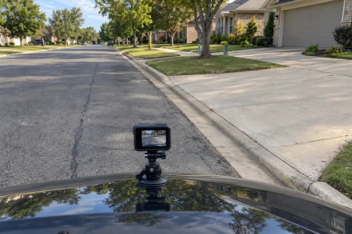
Mount a GPS-equipped GoPro action camera to a vehicle window, survey cart, or hand-held survey pole. Drive or walk the neighborhood streets, capturing continuous high-definition footage of every driveway apron, curb line, and sidewalk intersection.
Extract Telemetry Locally in Your Browser
Open maps.video on your laptop or workstation. Drag and drop the GoPro video file into the browser window. Telemetry is parsed locally on your device—no video files are uploaded over cellular or cloud networks.
Extract & Share Stamped Frame Proofs
Click any point along the rendered GPS map track to jump directly to that exact frame in the recording. Export stamped, geotagged video frames to email directly to clients, attach to PDF condition reports, or submit in legal defense files.
Core Technical Capabilities for Condition Audits
Instant Local Telemetry Extraction
GoPro action cameras embed high-frequency GPS metadata directly within raw MP4 video streams. maps.video extracts this telemetry locally within your web browser without requiring cloud uploads or processing servers.
- Eliminate cloud subscription fees and storage limits.
- Preserve mobile bandwidth on remote residential job sites.
- Ensure total data privacy by keeping all video footage on your drive.
Click-to-Coordinate Inspection
The interactive interface links a vector map trace directly alongside your video player. Moving along the map route instantly jumps the video feed to that exact coordinate.
- Inspect driveway aprons, curb cuts, and gutters at exact street addresses.
- Verify pre-existing crack patterns, spalling, and curb displacement.
- Extract high-resolution, GPS-stamped photo frames with a single click.
KML/KMZ & Esri Basemap Overlays
Import parcel boundaries, right-of-way (ROW) lines, or municipal utility CAD layers directly into the map view.
- Compare recorded GoPro routes directly against property parcel lines.
- Toggle Esri basemaps via ArcGIS integration for high-res satellite context.
- Confirm survey routes cover all required project boundaries.
White-Labeled Stamped Frame Deliverables
Clients, HOA boards, and municipal auditors do not need software access or login credentials to review your audit evidence.
- Export standalone image frames stamped with exact coordinates, dates, and times.
- Email frame proofs directly or attach them to standard PDF condition logs.
- Maintain professional identity with clean, white-labeled output options.

Condition Audit Documentation Workflow Comparison
How maps.video compares to traditional photo logging and unmapped video files
| Documentation Feature | Traditional Photo Logs | Standard Video Files | maps.video Platform |
|---|---|---|---|
| Hardware Requirement | Smartphones / Cameras | Any Camcorder / Phone | GoPro GPS Action Cameras Only |
| Spatial Precision | Low (Isolated JPEG pins) | None (Single file tag) | Continuous GoPro GPS Path Linking |
| Data & Storage Model | Manual folder organization | Heavy cloud video uploads | 100% Local In-Browser Processing (Zero Uploads) |
| Sharing Method | Massive PDF / ZIP folders | Shareable video links / Streaming | Export Stamped Frames (Email / Report Attachments) |
| Auditor Verification Time | High (Manual photo searching) | High (Scrubbing unmapped video) | Ultra-Fast (Click route point & export frame) |
| Design Layer Integration | Static paper/PDF overlays | No map integration | Interactive KML/KMZ & Esri Basemaps |
Eliminating Fraudulent Damage Claims & Speeding Sign-Offs
A single disputed driveway apron or broken curb replacement claim can easily cost contractors thousands of dollars in repairs and weeks in withheld retainage.
Traditional Claim Dispute Cycle (30–90 Days)
Homeowner Claim ➔ Disputed Baseline Evidence ➔ Manual Field Re-Inspections ➔ Legal / Insurance Reviews ➔ Retainage Withheld
maps.video Stamped Frame Workflow (Same Day)
Homeowner Claim ➔ Open Local GoPro Route ➔ Export Stamped Pre-Construction Frame Proof ➔ Claim Dismissed / Immediate Sign-off
By replacing fragmented smartphone photos with continuous local GoPro GPS mapping:
- Refute Unearned Property Claims: Produce conclusive, timestamped, and geotagged visual proof showing exact driveway and curb conditions prior to mobilization.
- Accelerate Retainage Release: Provide municipal public works auditors and HOA boards with clear frame proofs to close out permits and release held funds faster.
- Protect Subcontractor Margins: Maintain an undeniable historical record of every property line without incurring cloud storage overhead or video hosting fees.
Frequently Asked Questions
Everything you need to know about local GoPro GPS extraction and driveway/curb audit deliverables
Q: Why does maps.video use GoPro cameras exclusively?
A: GoPro action cameras feature robust built-in GPS receivers that log precise spatial metadata (telemetry) synchronously alongside HD video streams. This enables maps.video to parse accurate location tracks directly from the file without requiring external GPS loggers or custom hardware.
Q: Does maps.video create shareable video links?
A: No. maps.video operates on a privacy-first, local-browser model. No video files are uploaded to cloud servers or hosted online, meaning there are no shareable video web links. All video remains securely stored on your local drive.
Q: How do clients or inspectors review my condition audit?
A: You extract stamped, geotagged video frames directly from key inspection points along the map line. These image files feature embedded location coordinates, date, and timestamp data, making them perfect for emailing directly to clients, attaching to PDF audit reports, or embedding into billing submittals.
Q: Can we overlay property parcel boundaries onto the audit map?
A: Yes. maps.video supports standard KML and KMZ spatial files. You can overlay parcel boundaries, right-of-way limits, and municipal utility CAD lines directly on top of your interactive video route map.
Built for Civil Contractors, HOA Boards, and Public Works Auditors
Integrating seamlessly into daily field operations using off-the-shelf GoPro hardware
For Paving & Civil Superintendents
Ensure complete pre-construction baseline coverage across entire subdivisions without spending days manually photographing individual driveways and curbs.
For HOA Boards & Property Managers
Conduct thorough, systematic condition audits of community curb lines, valley gutters, and driveway aprons prior to developer turnovers or major paving projects.
For Municipal Public Works Inspectors
Review civil contractor right-of-way restorations, ADA curb ramp installs, and apron repairs with indisputable, location-stamped visual frame evidence.
"The maps.video local application has made it really easy to access and control HD video playback... It's allowed me to create a fully mapped video library of a city or town's road network using hardware (GoPro cameras) that I already owned."
Upgrade Your Driveway & Curb Audits Today
Stop relying on fragmented photos and unverified reports to document property access and curb infrastructure. Elevate your audit standards, protect your team from false claims, and build an unassailable visual record of your work.
Test maps.video with Sample Footage