
Road Striping Surveys GPS Video Mapping & Stamped Frame Proofs
Verify thousands of miles of highway striping, audit thermoplastic paint compliance, and deliver indisputable proof of work completed using standard GoPro cameras—without uploading raw video or managing third-party cloud links.
The application was intuitive to use and displayed exactly the kind of information we needed to show to our clients. It was very convenient not having to download additional software on the user or client side. Whenever video roadway survey work comes along, we know who to turn to!
— Donovan Bradshaw, Lead Geotechnical Engineer

Loved it. Having worked with it the past few months with a few guys, it’s been very easy to work with. With the amount of video files we have, all we need to have is an external hard drive plugged in and that’s it. Earlier this week, we sat down with the town to show them the work we’ve done, and they loved it as well
. — Victor Zhang, PE Sr. Structural/Bridge Engineer
The maps.video local application has made it really easy to access and control HD video playback, which has made determining the location of roadway features very efficient. It’s allowed me to create a fully mapped video library of a city or town’s road network using hardware (GoPro cameras) that I already owned.
— Lance Baden, Consultant

The application was intuitive to use and displayed exactly the kind of information we needed to show to our clients. It was very convenient not having to download additional software on the user or client side. Whenever video roadway survey work comes along, we know who to turn to!
— Donovan Bradshaw, Lead Geotechnical Engineer
Loved it. Having worked with it the past few months with a few guys, it’s been very easy to work with. With the amount of video files we have, all we need to have is an external hard drive plugged in and that’s it. Earlier this week, we sat down with the town to show them the work we’ve done, and they loved it as well
. — Victor Zhang, PE Sr. Structural/Bridge Engineer
The maps.video local application has made it really easy to access and control HD video playback, which has made determining the location of roadway features very efficient. It’s allowed me to create a fully mapped video library of a city or town’s road network using hardware (GoPro cameras) that I already owned.
— Lance Baden, Consultant
Road striping contractors, State Departments of Transportation (DOTs), municipal public works departments, and airport operations teams manage thousands of linear miles of critical pavement markings. Whether applying hot-melt thermoplastic, waterborne traffic paint, retroreflective glass beads, or auditing MUTCD-compliant crosswalks and airfield markings, verifying linear footage compliance and retroreflectivity condition is vital for public safety and contractor pay application approvals.
Auditing long linear highway striping corridors across state routes or municipal networks traditionally introduces massive operational friction:
- Unmanageable Mileage & Unmapped Video: Reviewing hundreds of hours of raw video to locate a specific missing skip line, failed hatch zone, or poor paint edge requires days of tedious scrubbing.
- Fragmented Photo Logs: Disconnected static photos fail to prove continuous striping continuity across multi-mile highway contracts or verify complete job site coverage.
- Severe Cloud Upload & Bandwidth Bottlenecks: Capturing 4K GoPro footage across miles of road networks generates massive multi-gigabyte files. Uploading raw video over field cellular connections is slow, costly, and impractical.
- Government IT & Cybersecurity Restrictions: External cloud hosting portals and shareable links frequently break, expire, or violate DOT and municipal cybersecurity policies.
Maps.video provides a fast, local-first alternative designed specifically for road striping survey workflows. The platform requires no complex AI processing queues or expensive cloud subscriptions. Instead, maps.video runs directly inside your local web browser, leveraging standard off-the-shelf GoPro action cameras equipped with built-in high-frequency GPS receivers.
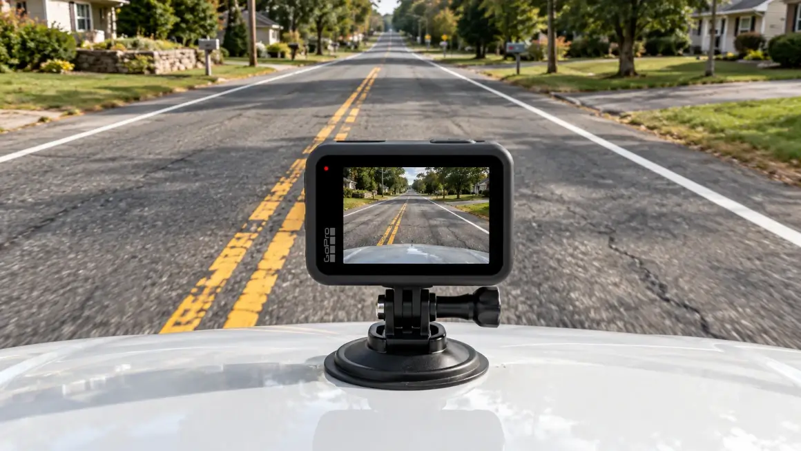
Striping crews and highway inspectors mount a GoPro to striping trucks, survey vehicles, or inspection cars. As you drive, the camera records continuous high-definition video while embedding spatial telemetry directly into the MP4 file stream. In the field office or headquarters, simply drag the video into maps.video. The system instantly parses embedded spatial coordinates locally in seconds—requiring zero megabytes of cloud upload. When auditing striping quality or backing up contractor pay submittals, click any point on the interactive route map to jump directly to that exact stationing and extract high-resolution, time- and location-stamped video frames. These stamped proof images can be emailed directly to DOT engineers or attached to formal PDF inspection reports.

Key Road Striping Workflows & Applications Supported
Verify thousands of miles of road striping assets, record indisputable proof of work completed, and settle pay application submittals without cloud software bloat.
Pre-Striping & Subcontractor Quality Assurance
- Pre-Striping Surface Audits: Document existing pavement surface condition, oil residue, milled asphalt, and old line ghosting prior to mobilization.
- Subcontractor Mileage Verification: Audit exact linear feet and miles of pavement markings applied across long state highway contracts.
- Glass Bead & Wear Audits: Visually inspect glass bead dispersion, thermoplastic thickness, and paint degradation across road corridors.
Post-Installation & DOT Acceptance
- DOT & Municipal Handover Sign-Offs: Produce location-stamped frame evidence for rapid contract closure and retainage release.
- MUTCD Stencils & Transverse Markings: Inspect crosswalks, stop bars, turn arrows, bike lanes, and airfield apron markings.
- Defend Against Defect Claims: Refute claims of non-compliant striping or premature wear using geotagged baseline evidence.
- Audit 1,000s of Miles Effortlessly: Navigate vast road striping networks by clicking interactive route points rather than manually scrubbing unmapped video files.
- 100% Local Data Security: Keep raw video files safely on internal local storage while exporting clean, stamped image proofs for formal submittals.
How maps.video Works for Road Striping Surveys
Continuous video mapping and local proof-of-work extraction from GoPro cameras directly inside your web browser
Works with GoPro HERO13, HERO11, HERO10, HERO9, HERO8, HERO7, HERO6, HERO5, MAX2, MAX, Fusion, Session 5 and .gpx.
Record Striping Runs with GoPro Hardware
Mount a GPS-enabled GoPro camera to a striping truck, survey vehicle, or inspection car. Drive target corridors at low speeds to capture high-definition video and spatial GPS telemetry.
Extract Telemetry Locally in Your Browser
Open maps.video on your laptop or workstation and drop in the GoPro MP4 file. The system extracts embedded spatial metadata locally in seconds—zero cloud bandwidth required.
Extract & Share Stamped Frame Proofs
Click any point along the rendered route map to jump the video directly to that stationing. Extract high-definition, geotagged, and timestamped video frames to attach to PDF reports or emails.
Core Technical Capabilities for Road Striping Teams
Instant Local Telemetry Extraction
GoPro action cameras log accurate spatial data directly within standard MP4 video streams. Maps.video parses this telemetry locally in your browser without transmitting raw video to cloud servers.
- Eliminate recurring cloud video storage costs and bandwidth fees.
- Process thousands of miles of survey footage on field laptops without internet dependency.
- Maintain strict data security by keeping all raw video on internal company drives.
Click-to-Coordinate Continuous Striping Review
The interactive vector map syncs directly with the HD video player. Clicking any section of the mapped route instantly jumps the video to that exact physical location.
- Inspect glass bead reflectivity, stencil alignment, and paint condition at specific mileposts.
- Correlate physical line defects or gaps directly with exact GPS coordinates.
- Review long linear highway striping rapidly without manual video scrubbing delays.
KML/KMZ & Highway Alignment Overlays
Import highway stationing files, municipal street centerlines, or striping project boundaries directly into the map view.
- Overlay KML/KMZ vector files onto the interactive route map.
- Toggle Esri high-resolution satellite basemaps via native ArcGIS integration.
- Verify road striping coverage against official DOT highway design plans.
Stamped Frame Deliverables (No Hosted Links)
Maps.video does not host third-party shareable web links. Instead, you extract stamped video frames containing burned-in GPS coordinates, date, and timestamp metadata.
- Export clean, white-labeled geotagged photo frames with one click.
- Attach stamped frames directly into DOT daily inspection logs and pay submittals.
- Email proof images directly to client engineers without requiring portal logins.

Road Striping Survey Workflow Comparison
How maps.video compares to traditional photo logs and complex cloud platforms
| Documentation Feature | Traditional Photo Logs | Legacy Cloud Platforms | Maps.video Platform |
|---|---|---|---|
| Hardware Requirement | Handheld Cameras / Phones | Proprietary Profilers / Scanners | Standard GoPro Cameras (Built-in GPS) |
| Data Processing & Bandwidth | Manual folder organization | Heavy cloud video uploads | 100% Local In-Browser Processing (Zero Uploads) |
| Mileage Scale Capability | Low (Incomplete spot photos) | High (Expensive cloud storage) | High (Review 1,000s of miles effortlessly) |
| Deliverable Sharing Method | Loose Unorganized JPEGs | Cloud Portal Subscription Links | Export Geotagged Stamped Frames (Email / PDF) |
| Spatial Track Precision | Low (Isolated JPEG pins) | Variable (Cloud processing) | Continuous GoPro GPS Path Synchronization |
| Review Speed & Efficiency | Slow (Searching folders) | Medium (Scrubbing online video) | Ultra-Fast (Click route point & export frame) |
Streamlining Road Striping Audits Across 1,000s of Miles
Eliminate cloud hosting fees, accelerate contractor progress billing, and maintain complete visual accountability across road networks.
Traditional Road Striping Audit Cycle (30–60 Days)
Striping Application ➔ Manual Photo Searches ➔ Disputed Mileage / Quantities ➔ Slow Administrative Appeals ➔ Delayed Progress Payment
Maps.video Streamlined GoPro Workflow (1–2 Days)
Striping Application ➔ Local GoPro GPS Extraction (Same Day) ➔ Export Stamped Frame Proofs (Same Day) ➔ Immediate Approval
By implementing a local browser-based GoPro mapping workflow with maps.video:
- Accelerate Contractor Payments: Provide DOT engineers and prime contractors with indisputable linear mileage proof the same day striping is completed.
- Eliminate Cloud Video Costs: Avoid monthly user software locks or per-mile cloud video processing fees.
- Build an Unassailable Archive: Keep raw video files safely on company drives while sharing clean, white-labeled stamped frames for permanent project records.
Frequently Asked Questions
Everything you need to know about local GoPro GPS extraction and road striping survey deliverables
Q: Can maps.video handle thousands of miles of highway striping footage?
A: Yes. Because maps.video processes telemetry locally inside your browser, you can review thousands of miles of road striping without waiting for cloud uploads or server rendering queues.
Q: Why does maps.video rely on GoPro cameras?
A: GoPro action cameras feature robust internal GPS receivers that embed accurate spatial telemetry directly inside standard MP4 video streams. This enables maps.video to parse GPS tracks directly from the file without external loggers.
Q: Does maps.video create shareable video links?
A: No. Maps.video operates on a local-first model and does not upload video files to cloud servers or host footage online. There are no shareable video links. All raw video remains securely stored on your local workstation.
Q: How do client engineers, DOT inspectors, or prime contractors review proof of work?
A: You extract high-definition, geotagged video frames directly from key points along the map track. These stamped image frames feature burned-in GPS coordinates, dates, and timestamps, making them easy to email directly or attach to PDF reports.
Q: Is an internet connection required during field survey runs?
A: Yes, but because telemetry extraction and map synchronizations occur locally inside your web browser, maps.video can process recorded GoPro video files on field laptops over low-bandwidth field connections.
Q: Can I overlay road centerlines or highway stationing files on the map?
A: Yes. Maps.video supports standard KML and KMZ spatial files. You can overlay highway centerlines, stationing markers, or project boundaries directly on top of your interactive route map alongside Esri high-resolution satellite imagery.
Built for Striping Contractors, Highway Engineers, and Municipal Inspectors
Integrating seamlessly into road striping quality control and billing workflows using standard GoPro hardware
For Road Striping Contractors
Record indisputable proof of linear feet applied across long highway runs. Generate geotagged frame proofs to support pay applications and accelerate retainage release.
For DOT & Highway Maintenance Engineers
Audit glass bead reflectivity, stencil placement, and line wear across thousands of miles of state routes without scrubbing unmapped video files.
For Municipal Public Works & Airport Ops
Maintain complete visual oversight of municipal bike lanes, crosswalks, and airfield runway markings while keeping raw data private and eliminating expensive software bloat.
"The maps.video local application has made it really easy to access and control HD video playback... It's allowed me to create a fully mapped video library of a city or town's road network using hardware (GoPro cameras) that I already owned."
Upgrade Your Road Striping Survey Workflow Today
Stop paying thousands for complex cloud platforms you don't need. Experience fast, practical, browser-based GoPro road striping mapping and build an indisputable visual record of your striping work.
Test maps.video with Sample Footage