
Municipal Inspection Sign-Offs GPS Video Mapping & Stamped Frame Proofs
Eliminate inspector scheduling backlogs, streamline public works handovers, and verify miles of municipal infrastructure projects—without uploading raw video or managing cloud logins.
The application was intuitive to use and displayed exactly the kind of information we needed to show to our clients. It was very convenient not having to download additional software on the user or client side. Whenever video roadway survey work comes along, we know who to turn to!
— Donovan Bradshaw, Lead Geotechnical Engineer

Loved it. Having worked with it the past few months with a few guys, it’s been very easy to work with. With the amount of video files we have, all we need to have is an external hard drive plugged in and that’s it. Earlier this week, we sat down with the town to show them the work we’ve done, and they loved it as well
. — Victor Zhang, PE Sr. Structural/Bridge Engineer
The maps.video local application has made it really easy to access and control HD video playback, which has made determining the location of roadway features very efficient. It’s allowed me to create a fully mapped video library of a city or town’s road network using hardware (GoPro cameras) that I already owned.
— Lance Baden, Consultant

The application was intuitive to use and displayed exactly the kind of information we needed to show to our clients. It was very convenient not having to download additional software on the user or client side. Whenever video roadway survey work comes along, we know who to turn to!
— Donovan Bradshaw, Lead Geotechnical Engineer
Loved it. Having worked with it the past few months with a few guys, it’s been very easy to work with. With the amount of video files we have, all we need to have is an external hard drive plugged in and that’s it. Earlier this week, we sat down with the town to show them the work we’ve done, and they loved it as well
. — Victor Zhang, PE Sr. Structural/Bridge Engineer
The maps.video local application has made it really easy to access and control HD video playback, which has made determining the location of roadway features very efficient. It’s allowed me to create a fully mapped video library of a city or town’s road network using hardware (GoPro cameras) that I already owned.
— Lance Baden, Consultant
Municipal public works departments, city engineering divisions, regional utility districts, and heavy civil contractors operate under demanding regulatory frameworks and strict public accountability. Whether executing Capital Improvement Projects (CIP), managing right-of-way (ROW) occupancy permits, or supervising utility franchise work, obtaining official municipal inspection sign-offs is the ultimate gateway to project acceptance, permit closure, and retainage release.
However, traditional municipal sign-off workflows are chronically bottlenecked. City inspectors are often spread thin across dozens of active job sites, leading to project delays while field crews wait for physical walk-throughs. When municipal engineers demand proof of subsurface compaction, pipe bedding, storm drain outfall integrity, or ADA curb ramp compliance prior to final acceptance, standard documentation methods create endless administrative friction:
- Fragmented Smartphone Photos: Disconnected photos lack continuous spatial alignment along municipal corridors. Isolated images fail to provide city engineers with exact stationing, continuous linear context, or verifiable proof of full corridor compliance.
- Unmanageable Raw Video Files: Recording hours of site walkthroughs or drive-throughs creates massive multi-gigabyte video files. Scrubbing through unmapped MP4 footage to find a single catch basin or valve box wastes valuable engineering hours.
- Bandwidth & Municipal IT Security Restrictions: Transferring gigabytes of raw video over mobile networks on active job sites is painfully slow and costly. Furthermore, government IT policies and municipal security protocols often restrict cloud file sharing, third-party user accounts, and public external video portals.
maps.video resolves this core friction. Engineered specifically for off-the-shelf GoPro action cameras equipped with internal GPS receivers, maps.video processes spatial telemetry locally inside your web browser. Rather than relying on cloud hosting or creating complex shareable video links, maps.video allows contractors and inspectors to instantly link continuous video to interactive vector maps locally. When visual compliance evidence is required for Daily Inspection Reports (DIRs) or final sign-off submittals, field teams simply extract crisp, time-stamped and geotagged video frames from specific map coordinates to email directly to city engineers or attach directly to municipal permit logs.

Key Municipal Inspection & Public Works Workflows Supported
Public works compliance requires continuous visual verification across trenching, surface restoration, and asset installation phases before final project handover and permit closure.
Right-of-Way & Utility Infrastructure QA
- Trenching & Backfill Compliance: Document pipe bedding, utility separation distances, tracer wire attachment, and backfill compaction passes prior to surface closing.
- Stormwater & Drainage Audits: Capture visual proof of catch basin installations, headwall alignments, culvert integrity, and outfall erosion controls.
- Conduit & Duct Bank Runs: Verify subsurface electrical, fiber optic, and signal conduit placement against municipal standard details.
Surface Restoration & Asset Acceptance
- Pavement & Overlay Handover: Record continuous post-construction asphalt condition, joint tacking, and striping compliance across full municipal corridors.
- Curb, Gutter & ADA Compliance: Document concrete placement, dropped kerbs, tactile paving, and sidewalk restoration across municipal rights-of-way.
- Pre- & Post-Construction Baseline Audits: Establish an indisputable pre-work visual record to defend contractors and municipalities against false third-party damage claims.
- Bypass Inspector Bottlenecks: Provide city engineers with clear, location-stamped frame evidence that enables remote review and accelerated sign-offs without waiting for repeat physical site visits.
- Maintain 100% Data Security: Keep all raw municipal project video stored locally on internal secure drives while exporting only the required geotagged frame proofs.
How maps.video Works for Municipal Inspection Sign-Offs
Continuous video mapping and local proof-of-work extraction from GoPro cameras directly inside your web browser
Works with GoPro HERO13, HERO11, HERO10, HERO9, HERO8, HERO7, HERO6, HERO5, MAX2, MAX, Fusion, Session 5 and .gpx.
Record Corridor Runs with GoPro Cameras
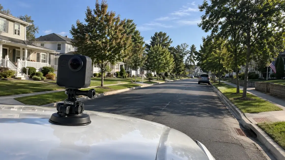
Mount a GPS-enabled GoPro action camera to a field vehicle, survey pole, or inspection helmet. Capture continuous HD video along open trenches, finished pavements, or municipal right-of-way assets.
Parse Telemetry Locally in Your Browser
Open maps.video on your laptop. Drag and drop the GoPro MP4 file directly into the browser window. Embedded GPS telemetry is parsed instantly on your local device—no cloud uploads or cellular data usage required.
Export & Share Stamped Frame Proofs
Click key inspection assets along the interactive route map to jump the video directly to that point. Extract high-resolution, time- and location-stamped video frames to email directly to city inspectors or attach to daily sign-off reports.
Core Technical Capabilities for Civil Contractors & Municipal Teams
Instant Local Telemetry Extraction
GoPro action cameras embed high-frequency GPS spatial data directly into recorded video files. While legacy platforms force users to upload gigabytes of video to external servers, maps.video parses telemetry locally within seconds.
- Eliminate heavy cloud processing wait times and cellular upload bottlenecks.
- Comply with municipal IT security rules by keeping raw footage on local storage.
- Process long linear corridor drives instantly on standard field laptops.
Click-to-Coordinate Map Navigation
The maps.video local interface links an interactive vector map directly alongside your video player. Clicking any stationing point, intersection, or asset pin on the route map instantly jumps the video player to that exact frame.
- Inspect specific manholes, valves, catch basins, or curb joins in seconds.
- Verify continuous work quality across miles of municipal roadway.
- Export geotagged video frames containing immutable geographic coordinates.
KML/KMZ & Esri Engineering Layer Overlays
Upload municipal CAD alignments, project boundary KML/KMZ files, or utility design layers directly into the map view to compare planned engineering drawings against actual recorded field paths.
- Verify that utility alignments remain strictly within permitted ROW boundaries.
- Toggle Esri high-resolution satellite imagery via ArcGIS integration for spatial context.
- Identify spatial deviations or utility conflicts before trench backfilling occurs.
Frictionless White-Labeled Frame Exports
City engineers, municipal auditors, and public works directors do not need software accounts, special logins, or cloud access to review your field submittals.
- Export high-resolution video frames stamped with time, date, and GPS coordinates.
- Maintain total brand integrity with clean, white-labeled image exports.
- Attach stamped proof images directly to Daily Inspection Reports (DIRs) and pay apps.

Municipal Inspection Documentation Workflow Comparison
How maps.video compares to traditional photo logs and unmapped video files
| Documentation Feature | Traditional Photo Logs | Standard Video Files | maps.video Platform |
|---|---|---|---|
| Spatial Precision | Low (Isolated JPEG pins) | None (Single file tag) | Continuous GoPro GPS Path Linking |
| Data Workflow & Security | Manual image naming & sorting | Heavy cloud video uploads | Browser-Based Local Telemetry Extraction |
| Coverage Continuity | Spotty (Gaps between photos) | Continuous (Hard to navigate) | 100% Continuous & Instantly Clickable |
| Inspector Verification Speed | Slow (Manual folder search) | Slow (Scrubbing unmapped video) | Ultra-Fast (Click route point & export frame) |
| Deliverable Format | Unverified raw images | Unmanageable raw MP4 files | Stamped Frame Proofs for Email & PDF Logs |
| Design Layer Integration | Static PDF overlays | No map integration | Interactive KML/KMZ & Esri Basemaps |
Accelerating Sign-Offs, Pay Applications & Retainage Release
Public works departments and municipal authorities routinely withhold progress payments or delay final retainage release due to unverified field items or incomplete inspection logs.
Traditional Municipal Approval Cycle (21–60 Days)
Work Execution ➔ Physical Inspector Backlog ➔ Disputed Items / Re-Inspections ➔ Administrative Reviews ➔ Delayed Sign-Off & Retainage
maps.video Sign-Off Cycle (1–2 Days)
Work Execution ➔ Local GoPro GPS Extraction (Same Day) ➔ Export Stamped Frame Proofs (Same Day) ➔ Fast Remote Inspector Sign-Off
By switching from unorganized photo folders to local GoPro GPS video mapping:
- Speed Up Progress Billing Approvals: Provide city engineers and municipal auditors with indisputable, geotagged visual proof that validates Schedule of Values line items on the day of billing.
- Resolve Punch List Disputes Instantly: Eliminate debate over asset locations, surface restoration standards, or site clearance by sharing exact time-stamped video frame evidence.
- Protect Project Margins: Prevent costly crew standing time while waiting for physical inspector site visits by providing high-density visual submittals that support remote sign-offs.
Frequently Asked Questions
Everything you need to know about local GoPro GPS extraction and municipal inspection sign-off deliverables
Q: What camera hardware is required for municipal mapping?
A: maps.video is engineered specifically for GoPro action cameras with built-in GPS telemetry (such as GoPro HERO models). The software reads embedded spatial metadata recorded natively by the camera.
Q: Does maps.video upload municipal project video to external cloud servers?
A: No. maps.video utilizes a local-first architecture. All GPS telemetry parsing, map synchronizations, and frame extraction take place entirely within your local web browser. Video files remain completely private on your local machine or company network.
Q: How do city inspectors or engineering consultants review proof of work without shareable links?
A: maps.video does not require cloud-hosted video links or external portal logins. Instead, you click exact points along your mapped route to export high-resolution video frames stamped with GPS coordinates, time, and date. These stamped image files can be emailed directly, attached to Daily Inspection Reports (DIRs), or uploaded into municipal permit systems.
Q: Can I overlay city GIS asset layers or project CAD drawings onto the map?
A: Yes. maps.video allows you to load custom KML or KMZ files directly into the map view. You can overlay proposed storm sewer lines, water mains, right-of-way boundaries, or road centerlines directly over the map alongside Esri high-resolution satellite imagery.
Built for Municipal Inspectors, Civil Contractors, and Public Works Directors
Integrating seamlessly into daily municipal engineering and construction workflows using off-the-shelf GoPro hardware
For Project Superintendents & Foremen
Capture complete corridor coverage during daily operations without stopping to take hundreds of manual phone photos. Provide indisputable proof of work completed before backfilling or paving.
For Municipal Inspectors & Resident Engineers
Review completed field work remotely with high spatial precision. Audit trenching, appurtenances, and surface restoration without driving between multiple backlogged job sites.
For Public Works Directors & Project Managers
Protect project cash flow and municipal audit trails. Maintain an unassailable visual archive of public infrastructure installations to streamline permit closures and retainage release.
"The maps.video local application has made it really easy to access and control HD video playback... It's allowed me to create a fully mapped video library of a city or town's road network using hardware (GoPro cameras) that I already owned."
Upgrade Your Municipal Inspection Documentation Today
Stop relying on fragmented photos and unverified reports to document critical public infrastructure. Elevate your documentation standards, speed up city approvals, and build an unassailable record of your work.
Test maps.video with Sample Footage