
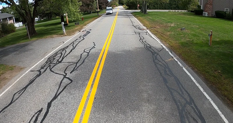
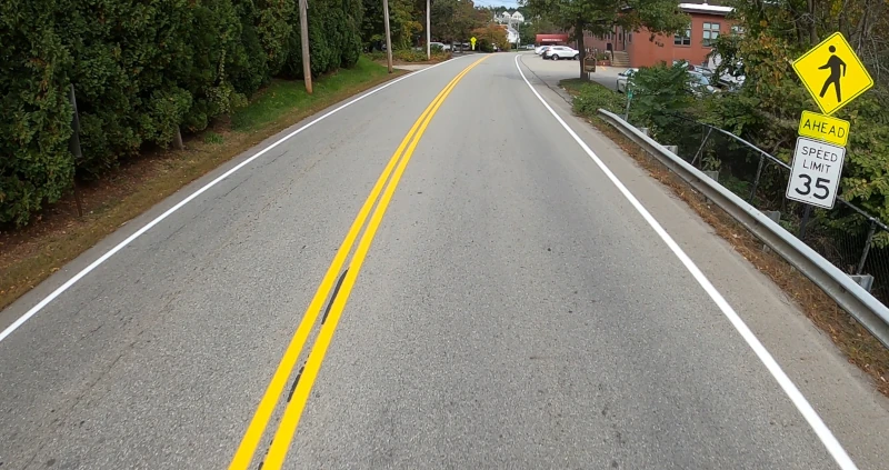
Compelling Before and After GPS Video Proof

Key Benefits
-
Video helps to record every inch of long work sites leaving nothing missed.
-
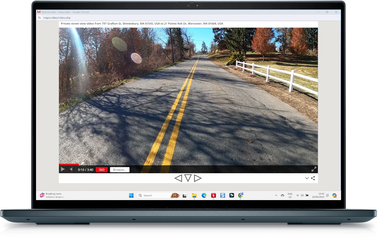
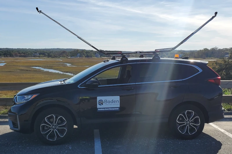
Use GoPro cameras to record video of key points in construction such as before and after utility cut restorations.
-
The videos have location data embedded at every point in the video as the GoPro has a built-in GPS.
-
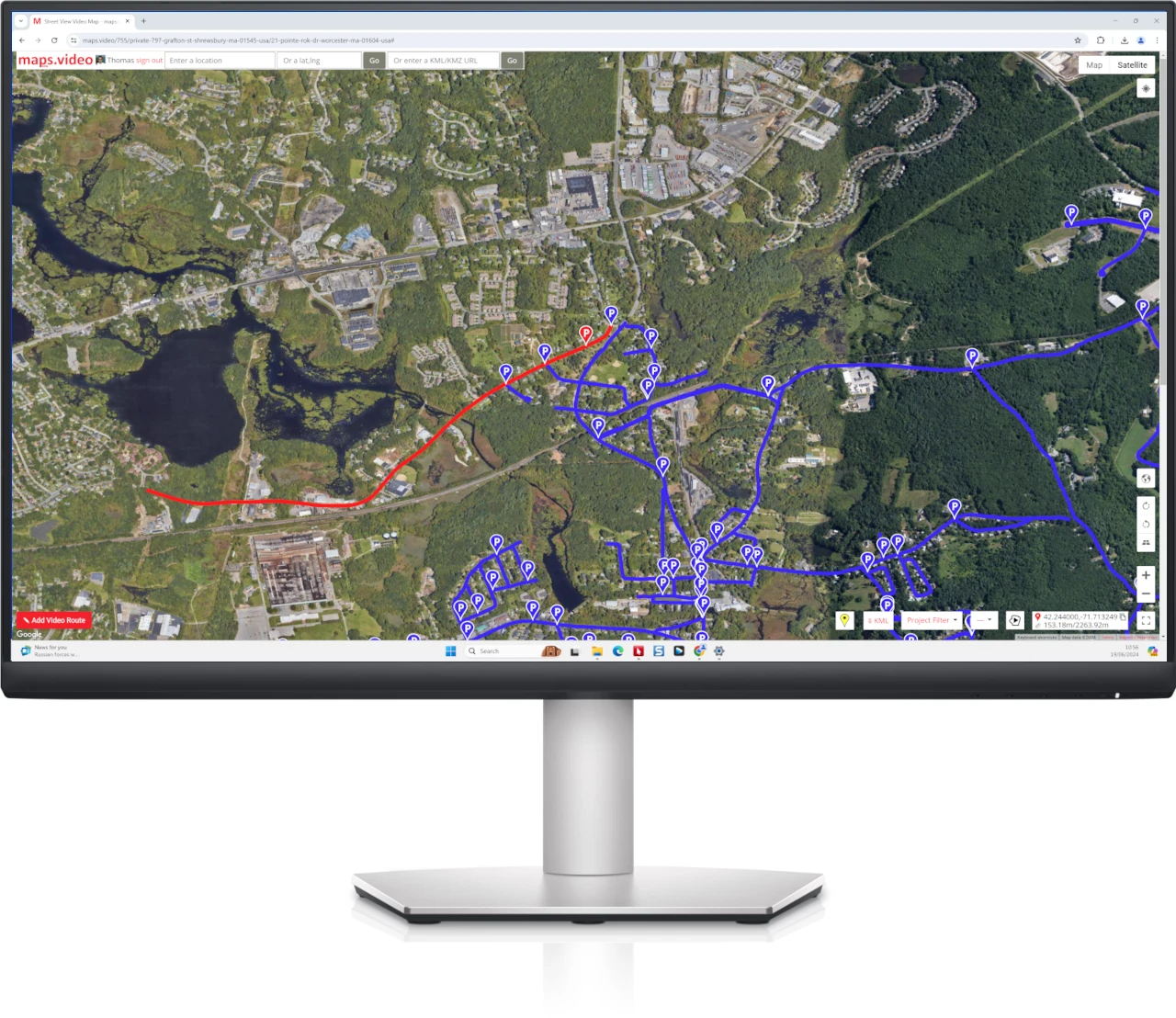
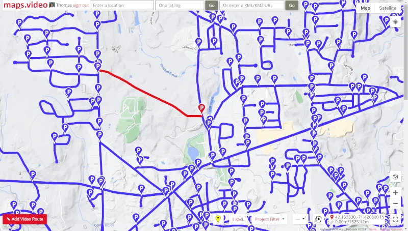
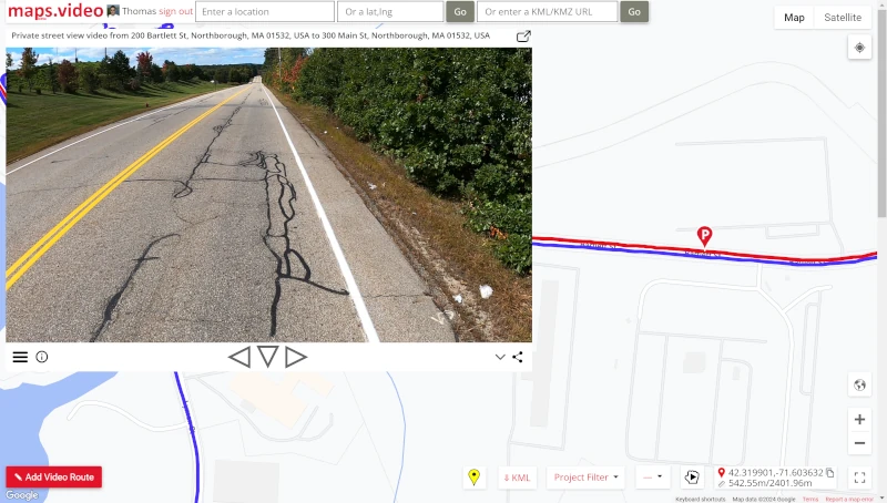
If you ever need to prove work done to standards just find the location in the video with the searchable map tools and click the yellow camera button to extract the video frame as a location and timestamped photo.
-
These photos will provide compelling before and after visual proof and allow you to rest easy knowing you can easily defend any potential claims.
Added benefits of using geolocated video
-
View and manage hundreds of work sites remotely, quickly and easily.
-
Improved stakeholder communication via viewing of geospatially accurate data.
-
Enhanced accuracy due to ability to search videos by latitude and longitude.
-
Increased efficiency in viewing construction process captured videography.
-
Less wasted trips to field and enhanced estimating accuracy.
-
Plus: work in a team environment when utilising the team subscription.
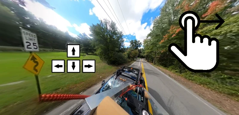
Why GoPro Video Cameras?
Inexpensive and versatile video cameras.
Built in GPS receiver synchronises video precisely with location.
HyperSmooth in-camera video stabilisation for shake free video.
Choice of 2D or 360 video formats.
maps.video native support for GoPro GPS extraction.
Useful mounts and accessories available.
Easy to mount on vehicle exterior for clear view.
GoPro smartphone app to control camera.
Excellent video quality up to 8K resolution.
Easy to learn and basic settings work well.
Ideal for proof, visual surveys and street view.
Subscription Plans
BUSINESS UNLIMITED TEAM
4 Team Members
Unlimited Mileage †
Unlimited Projects †
Unlimited Video Routes †
GoPro Batch Tool
Add and Delete Video Routes at Will
Free Support
Friendly Staff
Cancel anytime for any reason
SIGN UP NOW
† Keep up with payments to keep video routes.
BUSINESS UNLIMITED SOLO
Solo Member
Unlimited Mileage †
Unlimited Projects †
Unlimited Video Routes †
GoPro Batch Tool
Add and Delete Video Routes at Will
Free Support
Friendly Staff
Cancel anytime for any reason
SIGN UP NOW
† Keep up with payments to keep video routes.
Create your own private street view quickly and easily
Multiple camera angles at no extra cost
Analyse roadway features and answer client questions
Check condition of roadway assets
360 video with GoPro Max/Fusion using mouse or cursors
The power of Google Maps and now Esri ArcGIS Maps too
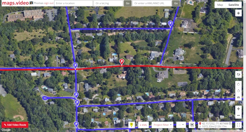
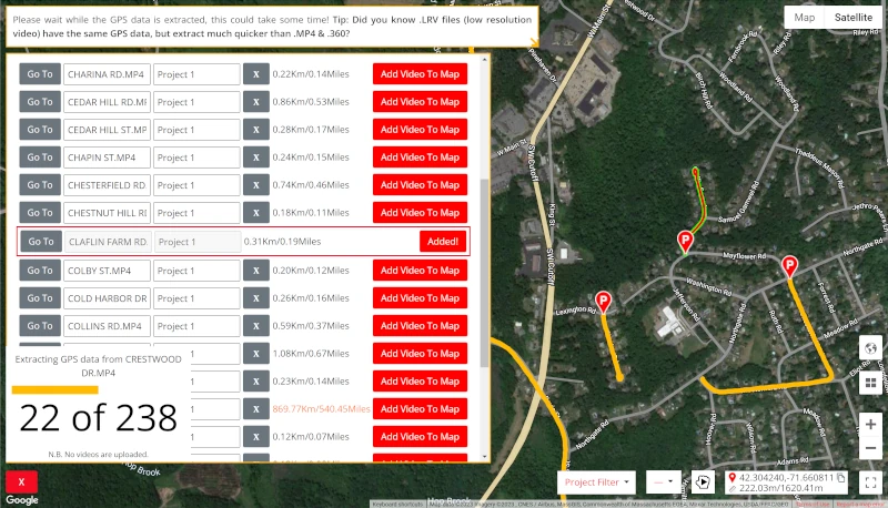
Quickly add hundreds of GoPro video routes, no uploading needed
GoPro video from your hard drive without added compression or buffering
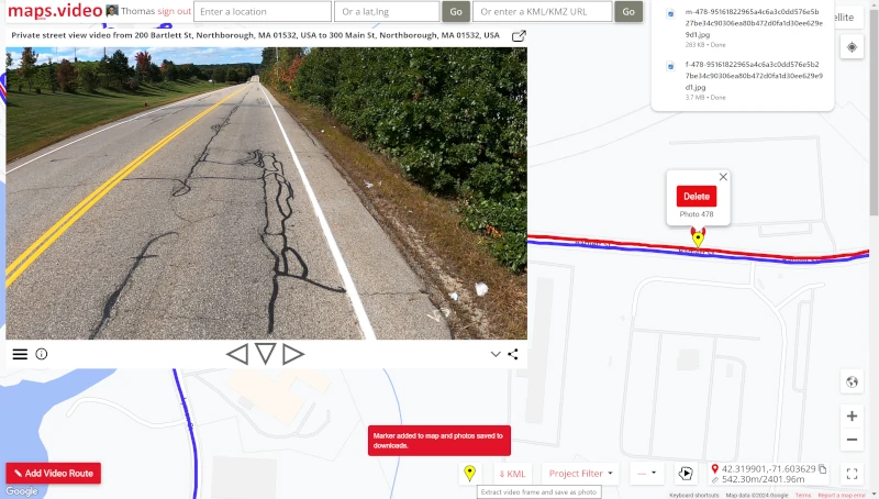
Extract video frame, download as photos and drop POI photo marker
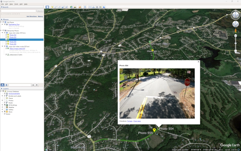
Download video route as KML and load in Google Earth or esri ArcGIS
maps.video Benefits
-
Free Trial
-
Unlimited Mileage
-
Unlimited Projects
-
Unlimited Video Routes
-
Unlimited Views & Plays
-
Batch GoPro Tool
-
Fully Private Video Routes
-
Friendly Staff
-
Free Support
-
Pro Subscription Available
Subscription Plans
BUSINESS UNLIMITED TEAM
4 Team Members
Unlimited Mileage †
Unlimited Projects †
Unlimited Video Routes †
GoPro Batch Tool
Add and Delete Video Routes at Will
Free Support
Friendly Staff
Cancel anytime for any reason
SIGN UP NOW
† Keep up with payments to keep video routes.
BUSINESS UNLIMITED SOLO
Solo Member
Unlimited Mileage †
Unlimited Projects †
Unlimited Video Routes †
GoPro Batch Tool
Add and Delete Video Routes at Will
Free Support
Friendly Staff
Cancel anytime for any reason
SIGN UP NOW
† Keep up with payments to keep video routes.