Cost-Effective Road and Pavement Surveys Using GoPro Cameras
Start NOW. Its easy!
Works with GoPro HERO13, HERO11, HERO10, HERO9, HERO8, HERO7, HERO6, HERO5, Max, Fusion, Session 5 and .gpx.
Loved it. Having worked with it the past few months with a few guys, it’s been very easy to work with. With the amount of video files we have, all we need to have is an external hard drive plugged in and that’s it. Earlier this week, we sat down with the town to show them the work we’ve done, and they loved it as well.
The maps.video local application has made it really easy to access and control HD video playback, which has made determining the location of roadway features very efficient. It’s allowed me to create a fully mapped video library of a city or town’s road network using hardware (GoPro cameras) that I already owned.
![]()
Use Cases
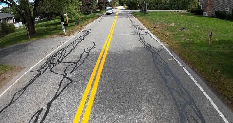
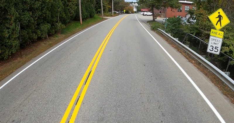
Road Surveys
Pavement Restoration
360° VR Street View
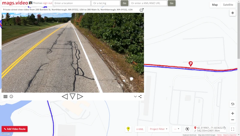
Private Street View
Visual Condition Surveys
Pothole Surveys
Course Visual Inspections (CVI)
Pavement Surveys
Sidewalk Surveys
Mobile Inventory Surveys
Mobile Mapping Surveys
Line Marking Surveys
Fibre Optic Trenching Surveys
Vegetation Management
Quality Control
Estimating
Why GoPro for Above Use Cases?
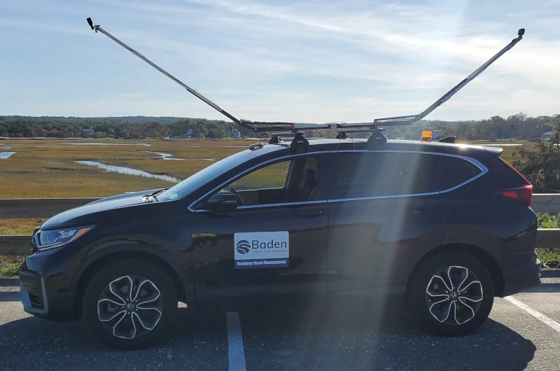
Inexpensive and versatile video cameras
HyperSmooth in-camera video stabilisation for shake free video
Choice of 2D or 360 video formats
Built in GPS receiver synchronises video precisely with location
maps.video native support for GoPro GPS extraction
Useful mounts and accessories available
Easy to mount on vehicle exterior for clear view
GoPro Remote option to control camera
Good video quality up to 5.6K resolution
Easy to learn
Basic settings work well
Ideal for visual surveys and street view
maps.video for Visual Surveys and Street View
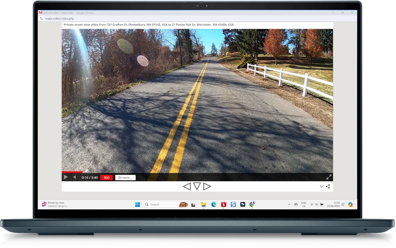
Create your own private street view quickly and easily
Multiple camera angles at no extra cost
Analyse roadway features and answer client questions
Check condition of roadway assets
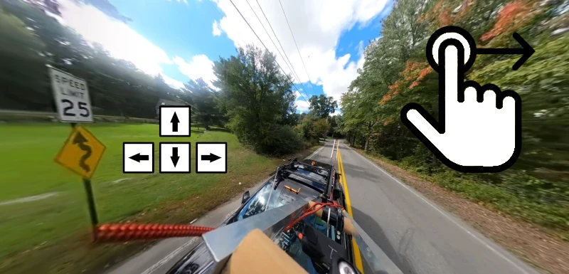
360 video with GoPro Max/Fusion using mouse or cursor keys
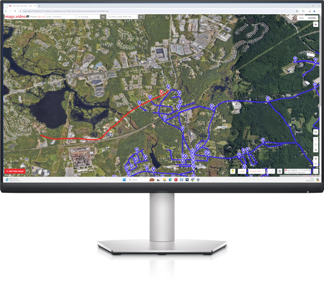
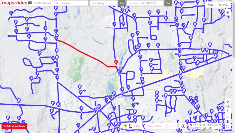
The power of Google Maps and now Esri ArcGIS Maps too
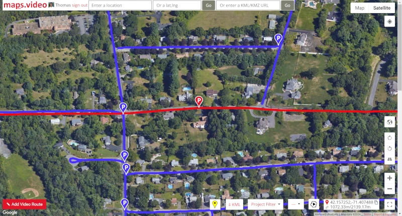
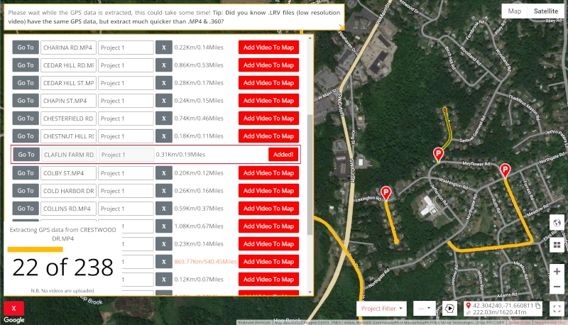
Quickly add hundreds of GoPro video routes, no uploading needed
GoPro video from your hard drive without added compression or buffering
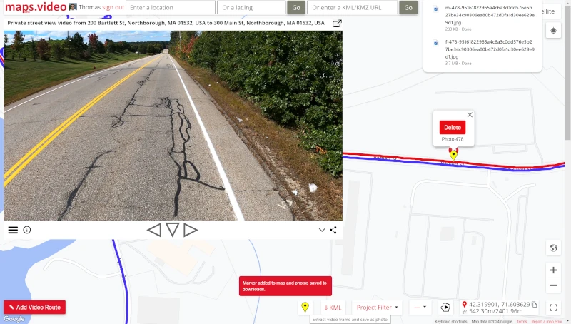
Extract video frame, download as photos and drop POI photo marker
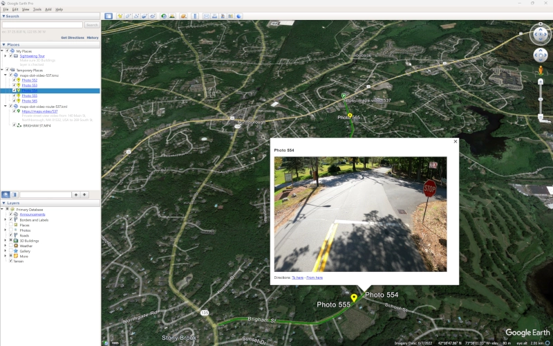
Download video route as KMZ and load in Google Earth or esri ArcGIS
maps.video Benefits
-
Free Trial
-
Unlimited Mileage
-
Unlimited Projects
-
Unlimited Video Routes
-
Unlimited Views & Plays
-
Batch GoPro Tool
-
Fully Private Video Routes
-
Friendly Staff
-
Free Support
-
Subscription Available
Subscribe Now
BUSINESS UNLIMITED
Unlimited Mileage *
Unlimited Projects *
Unlimited Video Routes *
GoPro Batch Tool
Add and Delete Video Routes at Will
Free Public Viewers - just need copy of videos
Free Support
Friendly Staff
Fully Private Video Routes Also
$40/user/mo
LIMITED TIME OFFER - Get First Month Completely FREE
Cancel anytime for any reason
SIGN UP NOW
* Keep up with payments to keep video routes.
Loved it. Having worked with it the past few months with a few guys, it’s been very easy to work with. With the amount of video files we have, all we need to have is an external hard drive plugged in and that’s it. Earlier this week, we sat down with the town to show them the work we’ve done, and they loved it as well.
The maps.video local application has made it really easy to access and control HD video playback, which has made determining the location of roadway features very efficient. It’s allowed me to create a fully mapped video library of a city or town’s road network using hardware (GoPro cameras) that I already owned.
![]()